|
©The Archaeological Settlements of Turkey - TAY Project
|
|
|
|
|
|
Dedetepe |
|
|
For site maps and drawings please click on the picture...  |
For photographs please click on the photo... 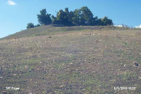 |
|
Type:
|
Mound |
|
Altitude:
|
80 m |
|
Region:
|
Black Sea |
|
Province:
|
Samsun |
|
District:
|
Alaçam |
|
Village:
|
Yenice |
|
Investigation Method:
|
Survey |
|
Period:
|
Early Iron Age Middle Iron Age Late Iron Age |
|
|
|
 |
|
| It lies northwest of the Yenice Village, 20 km south of the BAfra-Alaçam motorway, 19.5 km northwest of the Bafra District in Samsun. It is a high settlement covered by trees. It is listed among the registered archaeological sites prepared by the Ministry of Culture and Tourism. Sherds from the Late Chalcolithic Age, Early Bronze Age, Middle Bronze Age and Late Iron Age were collected from the surface. It takes place in the registered archaeological sites list prepared by Ministry of Culture and Tourism. It is stated in Samsun Culture Inventory that the mound is 60x35 m in dimension and 10 m in height. |
| Location: |
| Geography and Environment: |
| History: |
| Research and Excavation: |
| Stratigraphy: |
| Small Finds: |
| Remains: |
| Interpretation and Dating: |