|
©The Archaeological Settlements of Turkey - TAY Project
|
|
|
|
|
|
Dineksaray |
|
|
For site maps and drawings please click on the picture...  |
For photographs please click on the photo... 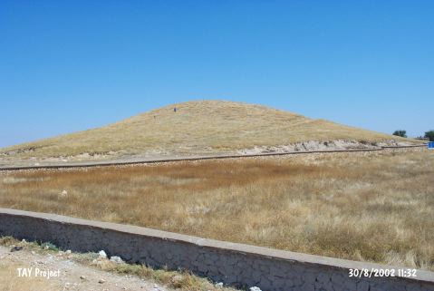 |
|
Type:
|
Mound |
|
Altitude:
|
1040 m |
|
Region:
|
Central Anatolia |
|
Province:
|
Karaman |
|
District:
|
Merkez |
|
Village:
|
Dinek |
|
Investigation Method:
|
Survey |
|
Period:
|
|
|
|
|
 |
|
| It is located between Dinek Village and Kilbasan Town in Konya. It lies to the southwest of the modern village at the 39th kilometers of the Konya-Bozkir motorway. The mound measures 75x75x10 m in dimensions. Discovered by J. Mellaart, it was investigated in 2000 during the surveys conducted in the provinces of Konya and Karaman under the direction of H. Bahar. At present, a mosque rises on the mound. Sherds dating to the Iron Age and Roman Period were collected from the surface. |
| Location: |
| Geography and Environment: |
| History: |
| Research and Excavation: |
| Stratigraphy: |
| Small Finds: |
| Remains: |
| Interpretation and Dating: |