|
©The Archaeological Settlements of Turkey - TAY Project
|
|
|
|
|
|
Efeköy |
|
|
For site maps and drawings please click on the picture...  |
For photographs please click on the photo... 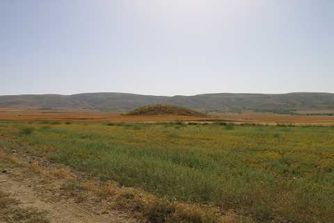 |
|
Type:
|
Mound |
|
Altitude:
|
1178 m |
|
Region:
|
Aegean |
|
Province:
|
Afyonkarahisar |
|
District:
|
Suhut |
|
Village:
|
Efe |
|
Investigation Method:
|
Survey |
|
Period:
|
EBA III EBA II |
|
|
|
 |
|
| It is situated in the plain northeast of Suhut District; southeast of Afyonkarahisar Province. It lies 2.8 km east of the town of Efe. It is illustrated in the map of the third and second millennia BC settlements within the territory of Afyon on the 15th page of the guide of the Afyon Archaeological Museum. No further information is provided. J. Mellaart and D.H. French do not refer to this mound. It was visited during the survey conducted by Koçak in 2011. It is located about 300 m east of Yarisli-Efeköy earth road, 3 km northeast of Yarisli Village. It measures 90 m long in SE-NW and 110 m long in SW-NE. EBA, Hellenistic and Roman sherds were encountered on the surface [Koçak 2013:44]. |
| Location: |
| Geography and Environment: |
| History: |
| Research and Excavation: |
| Stratigraphy: |
| Small Finds: |
| Remains: |
| Interpretation and Dating: |