|
©The Archaeological Settlements of Turkey - TAY Project
|
|
|
|
|
|
Egriköy |
|
|
For site maps and drawings please click on the picture...  |
For photographs please click on the photo... 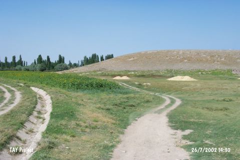 |
|
Type:
|
Mound |
|
Altitude:
|
1125 m |
|
Region:
|
Central Anatolia |
|
Province:
|
Kayseri |
|
District:
|
Yesilhisar |
|
Village:
|
Yesilova |
|
Investigation Method:
|
Survey |
|
Period:
|
|
|
|
|
 |
|
| It lies 700 m south of Yesilova Village; southeast of Yesilhisar District of Kayseri Province. Mount Erciyes stands at the northern view of the mound locating in a fertile plain. Mount Sakiz stands south of the site. There is water reservoir on the skirt of the mound built by Ministry of Urban and Rural Development in 1985. The site was discovered by M. Darga and dated to EBA. This site is revisited in 2009 during a survey carried out by Kulakoğlu and team. It is 21 m in height and in 250 m in diameter. The Northern and Eastern slopes are very steep while Southern slope is flatter. Natural rocks can be seen on the three corners of the mound and on the hill. Handmade and paint-decorated potteries, known as Alişar III are encountered in Kültepe Karum Layers IV, III and II. And this kind of pottery is also known from the late periods of EBA as encountered in Kültepe [Kulakoğlu et al. 2011.410-411]. |
| Location: |
| Geography and Environment: |
| History: |
| Research and Excavation: |
| Stratigraphy: |
| Small Finds: |
| Remains: |
| Interpretation and Dating: |