|
©The Archaeological Settlements of Turkey - TAY Project
|
|
|
|
|
|
Selimpasa |
|
|
For site maps and drawings please click on the picture... 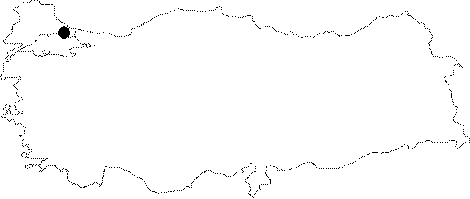 |
For photographs please click on the photo... 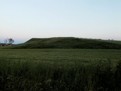 |
|
Type:
|
Mound |
|
Altitude:
|
10 m |
|
Region:
|
Marmara |
|
Province:
|
Istanbul |
|
District:
|
Silivri |
|
Village:
|
Selimpasa |
|
Investigation Method:
|
Survey |
|
Period:
|
|
|
|
|
 |
|
| It is situated on a natural elevation at the mouth of a stream, 3 km west of the Selimpasa Village between Istanbul and Tekirdag. It was discovered by D.H. French. Almost all the finds resemble the sherds at Troy phase I, with one exception, which is a wheelmade sherd described as grey colored by D.H. French. M. Özdogan suggests that it may have belonged to the Classical Age although it resembles the Grey Minyan type of ware seen starting from the level VI of Troy as they are no other sherds datable to that period. It takes place in the registered archaeological sites list prepared by Ministry of Culture and Tourism. |
| Location: It lies some 3 km west of the Selimpasa Village of the Silivri District; west of the Istanbul Province. It is one of the biggest mounds on the shore of Marmara Sea in the Thrace Region. Istanbul-Tekirdag motorway runs to the south of the mound. Between the motorway and the mound; is a secondary road to Selimpasa. |
| Geography and Environment: There is a small bay where the Kavakli and Kocadere Streams spill to; located west of Selimpasa Village. The mound stands on a natural elevation at the mouth of the stream; on the eastern bank of Kavakli Stream. The western foots of the hill are steep and the eastern and southern slopes are slightly inclined. The mound; threatened by the modern settlement to its west and west; has been taken under protection as a result of the announcement by the Istanbul Archaeological Museum as a registered site. |
| History: |
| Research and Excavation: |
| Stratigraphy: |
| Small Finds: |
| Remains: |
| Interpretation and Dating: |