|
©The Archaeological Settlements of Turkey - TAY Project
|
|
|
|
|
|
S 63/5 Siirtan |
|
|
For site maps and drawings please click on the picture...  |
For photographs please click on the photo... 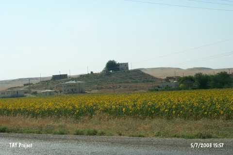 |
|
Type:
|
Mound |
|
Altitude:
|
910 m |
|
Region:
|
Southeastern Anatolia |
|
Province:
|
Siirt |
|
District:
|
Kurtalan |
|
Village:
|
Çayirli |
|
Investigation Method:
|
Survey |
|
Period:
|
|
|
|
|
 |
|
| It is situated in the Çayirli (Siirttan) Village, 200 km north of the Kurtalan-Batman motorway, approximately 12 km west of the Kurtalan District, 35 km west of Siirt as the crow flies. With a height of 25 m, and a diameter of 175 m, it is a pretty large settlement. The eastern slope has been obscured by the modern village settlement of the same name. It is reported that there also was a house on the hilltop during the survey in 1963. The mound lies within a narrow valley composed by the Göl Stream, which should be the one referred in the publication, flowing 100 m to the northwest. It contains probably the plain ware belonging to the first half of the 1st Millennium BC, and a similar group of red coated, burnished and wheelmade ware (particularly seen at Nemrut, Tell Halaf's Kabara level, Amique phase O, Syro-Hittite level at Hama and Palestinian Early Iron Age II). |
| Location: |
| Geography and Environment: |
| History: |
| Research and Excavation: |
| Stratigraphy: |
| Small Finds: |
| Remains: |
| Interpretation and Dating: |