|
©The Archaeological Settlements of Turkey - TAY Project
|
|
|
|
|
|
Tell Tayinat |
|
|
For site maps and drawings please click on the picture... 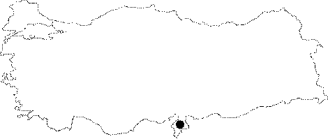 |
For photographs please click on the photo... 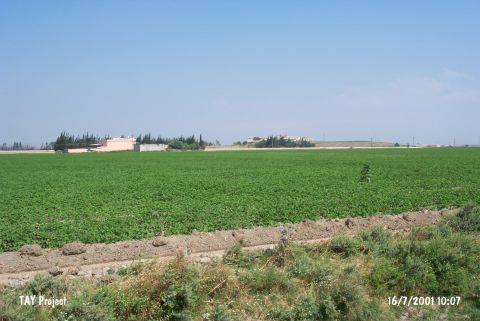 |
|
Type:
|
Mound |
|
Altitude:
|
160 m |
|
Region:
|
Mediterranean |
|
Province:
|
Hatay |
|
District:
|
Reyhanli |
|
Village:
|
Tayinat |
|
Investigation Method:
|
Excavation |
|
Period:
|
|
|
|
|
 |
|
| Location: It lies immediate north of the motorway connecting Antakya to Aleppo; Syria through Reyhanli over the Turkey-Syria border; 17; 5 km west of the Reyhanli District; east-northeast of the Antakya Province. It is easily accessible. |
| Geography and Environment: It is located on the northeastern side of the Asi River. It is an oval mound. It measures 15 m in height and 700x500 m in dimensions including the slopes [Braidwood-Braidwood 1962:fig.8]. During the excavation in 1935; it was obscured by the village of Tayinat. It is surrounded by a fertile land like the other settlements of the Amuq Plain. There is a fresh water spring nearby. It lays 1.4 km far east of the Asi River. Tell Tayinat consists of an upper and a lower mound and the lower mound is under a thick layer of debris which is commonly observed in the flood plains of Orontes at Amuk [Harrison et al. 2008:87]. |
| History: |
| Research and Excavation: Being discovered in 1933, the excavations (findspot no. 126 in the Survey of the Amuq Plain) were intiated in 1935, and terminated in 1938. Both the surveys and excavations were conducted by R.J. Braidwood under the auspices of the Oriental Institute of Chicago. As a result of re-evaluations in 1999 during the surveys conducted under the direction of T. Harrison, a second campaign was initiated in 2004 [Harrrison et al. 2006:353]. It takes place in the registered archaeological sites list prepared by Ministry of Culture and Tourism. |
| Stratigraphy: The site includes remains from the Early Bronze Age and Iron Age. The epigraphical finds dating to the Luwian/Late Hittite and Aramaean Periods indicate that Tell Tayinat was the ancient Kunulua, capital of the Neo-Hittite/Aramaean Kingdom of Patina/Unqi. The Iron Age levels were identified in two phases as Iron Age I (Amuq N) with 4 building levels, and Iron Age II (Amuq O) with 5 building levels. |
| Small Finds: Architecture: The architectural remains of Iron Age I were exposed in various sections. A small room of 1x2 m belongs to this period. Also found are many wall fragments which were destroyed during the construction of the main structure and annexes of the Iron Age temple. Despite stratigraphic uncertainty, this level yielded a silo plastered with clay and mud, a larger pit made of clay and pavement stones. The most prominent feature of the late phase of Iron Age I are the storage pits. Seven stratigraphical Site Levels could be differentiated during excavations performed at Site 1 where Iron Age I finds were yielded during 2005 excavations. Four different Early Iron Age levels were identified above EBA level which is the oldest level. Burnt marks were observed in Level 6. Level 5 was covered by several wall fragments in different sizes from Level 4. Although well preserved there is severe damage on level four remains due to Iron Age sanctuary main building and the secondary building constructions in Level 2 and the trenches in Level 3. Complexity is observed in Level 3 in terms of periods, due to being squeezed between levels 2 and 4. North and south adobe walls of the building identified as late 9th century BC or Iron IIB megaron style sanctuary revealed during 1930 excavations performed by the University of Chicago were unearthed. Level I was assigned for the alluvium layer that covers the excavation area formed by agricultural land cultivation remains after Iron Age [Harrison et al. 2008:88-90]. Large adobe walls were yielded at Site II where Iron Age II remains were found. Based on sherds these date to Late Iron I/Early Iron II period (10th - early 9th centuries BC). Building size and preservation quality suggest it is an important structure [Harrison et al. 2008:90-91]. Early Iron Age I settlement (12th century BC) that has close relations to Aegeis Region, and the Late Iron I/Early Iron II (10th - 9th centuries BC) monumental structure were continued to be unearthed at Site I in 2006 and 2007. Late Bronze/Early Iron I metal workshop at Site 4, is characterized as proof of importance of this area in that period, and suggests that the size of Early Iron Age settlement in the mound should be considered as much larger. The upper mound may be covering an area approximately 10-12 hectares [Harrison et al. 2009:515-516]. Architectural characteristics of the Iron Age II, which is represented by five building levels, can be described as follows: Building Level 1 was mainly formed in the West Central Area around an open courtyard, and it was exposed with structures XIII and XIV. The structure XII has a North-Syrian bit hilani plan. These two structures were leveled during the Building Level 1, and an entirely new complex of buildings were erected in their place, including the renown Bit Hilani palaces of Tayinat (building 1) and a megaron-style temple (building 2). Renovations to the buildings in the West Central Area accounted for most of the activity assigned to the Building Level 3. A large Assyrian building with courtyard uncovered on the southern end of the mound belongs to this phase as well. During the Building Level 4 the occupation of the Bit Hilani in the West Central Area continued, but the temple was abandaoned. A series of poorly preserved structures on the upper parts of the mound was observed on the Building Level 5 [Harrison et al. 2006:355]. Late Iron I/Early Iron II (10th - 9th centuries BC) monumental building (Building XIV) in Site II was continued to be unearthed. It is believed that the structure measuring 50x100 m, was the palace where Luwian kings of Padasatini resided [Harrison et al. 2009:515-516]. In 2008 large pits identified as storage silos covered by fossil plants were revealed at Area I inside trench G4.56 [Harrison-Batiuk (Lumb-Pieri) 2010:493-494]. Well preserved remains possibly belonging to a sanctuary lying in south direction were found inside Area 2 located in the north of Area 1. The sanctuary is accessed from the south by a long and narrow stairway consisting of four calcareous stone block steps. The porch forming the sanctuary's entrance through the stairway was composed of twelve courses of terra cotta bricks. There is a carved decorated partially buried basalt pedestal exactly in the center of this surface. That pedestal is similar to the basaltic pedestals that decorate Building I's entrance - that is the Bit Hilani Palace found further west by the Syro-Hittitian Discovery Committee. The porch was separated from the room further inside in the north by two adobe brick walls. Most of the area between two walls was covered by a possibly collapsed thick layer of burnt bricks. The entrance of the room provides passage into an internal room. It is assumed that the room composes the center of the sanctuary. The sanctuary was surrounded in the west and south directions by flat stones similar to curbstones [Harrison-Batiuk (Lanham et al.) 2010:494-496]. During the identification of metal workshop's limits unearthed during 2006 and 2007 excavations on the west side of the upper mound at Area 4's G3.34 location a well preserved stone paved surface and a part of the ditch related to the defense system built in the west were revealed. The stone paved surface was dated to Iron Age II [Harrison-Batiuk (Roames-Özbakkaloğlu) 2010:496-497]. In the Area 5 that was first excavated in 2008 a part of a Late Assyrian period large house with a courtyard was revealed. The floor covering of the courtyard was partially preserved, the rooms located north of the courtyard had white plastered walls, preserved up to a 1 m height or more [Harrison-Batiuk (Denel et al.) 2010:498-499]. Last year's studies have completed in 2009 and a level which contains a ground level is reached in Trench G4.55. Two architectural phases (FP 8 and 9) have unearthed that contains remains of a building that belongs to an earlier period with walls 1 m thick and 3 m high. It is observed that the supports inside the building are used for the roof or the upper level and represent a perfect architectural characteristic [Harrison et al. (L. Welton) 2011: 369]. Detailed records for building remains in Trench G4.56 are created. The building is believed to be connected with Field Phase 6 (FP 6). These structures mostly consist of large pits used for storage silos which are covered with fossil plants and which were studied during previous seasons [Harrison et al. (L. Welton) 2011: 370]. The temple structure which is believed to be from Iron Age II is completely excavated in Field 2. The entrance to the temple was enabled through a stairway of paved stones. A basaltic column is located in the west of the stairway in the South of the West Wall. And a large engraved column base which is placed tight on the platform where the stairway reaches is in the middle of veranda and emphasizes the entrance. The entrance veranda is separated by two raised walls from the internal space of the temple. Majority of the area between the two walls is covered by a thick layer of adobe debris suggesting fire marks. It is discovered that this destruction embankment also covered severely burnt three woollen pole remains. It is believed that at least one of these poles was sitting on the ground as the threshold pole. The sacred room which is the worshipping area at the very back of the building -behind the room inside- is separated from the room and veranda by two elevated walls. This room covers the North edge of the building and contains a rectangular platform which almost covers the entire floor. The base of the platform is covered with clay bricks and accessed through steps on two South corners. The room went through a severe fire. The construction technique of the temple has the same characteristics with the buildings on the West of the mound. "Wood crib" construction technique is deployed in these buildings. And it is found out that outside of the West wall of the temple is plastered with glossy white material and at least the West and South areas of the building is paved with slate stones which were removed by archaeologists from USA during their excavation. And a large area that is partially unearthed is believed to be a yard or a plaza. The excavations carried out to date have unearthed the latest periods when the temple structure is used, i.e. latest periods of Late Assyrian Power during Late 8th or Early 7th Century BC. When the usage of the temple is analysed it is found that during its later phases the importance of the temple have risen as it became a religious centre of a larger religious complex connected with the palaces of Late Hittite Kings, Patina/Unqi or palaces that belong to Palistin/Walistin Kingdom [Harrison et al. (J. Osborne) 2011: 370-372]. In 2009 remains of a series of additional walls on top of one another and a series of ground levels are found in Field 5. These are believed to contain transition periods from Iron Age I to Late Iron Age II (or to Iron Age III). The last phases of use of these walls and ground levels are believed to be associated with the large building with a yard in the West [Harrison et al. (J.P. Dessel) 2011: 373]. In 2011, remains that probably belong to a monumental gate were exposed in Trench G4.58. It is suggested that this monumental gate provided an access to the citadel in the Upper Mound during the phases dated to IA II (8th-9th century BC). It is seen that the excavated area is the west (or northwest) section of the monumental gate. This section consists of roughly sharpened limestone blocks that were aligned as a single row. It was immobilized with the corner blocks on its north and south edges. It is possible that this limestone row was used as a foundation or a kind of "stand" for basalt orthostats ornamenting the façade with the purpose of hiding the mudbrick brace. Mudbrick rubble extending towards the west of this stone row was exposed. It is suggested that these mudbrick rubble might be the west section of the mudbrick fill belonging to the monumental gate. The fact that the existence of a line formed with flat stones leaning against the interior section of the mudbrick bloks (the east) shows that these stones were used as a kind of bench in which the monumental gate is located. A white plaster like material was found on the east face these stones. It is suggested that this material coul be the remains of floor or main surface of the monumental gate. No remains of floor or surface were found in the external area where the monumental gate was exposed. Therefore, it is presumed that not all of it but some parts of the monumental gate was damaged or removed intentionally. In the present case, it is thought that the mudbrick rubble extending towards the west could be a part of the foundation belonging to the monumental gate complex and it functioned as a platform in which the gate was built. A basalt lion statue with garish decorations related to the monumental gate was found. This statue is about 1.3 m thick and 1.6 m long. It is understood that a second statue fragment belongs to the front face of the base of a large statue [Harrison et al. 2013:107-108]. The first sounding dug into Trench G4.48 was opened in front of the stairs leading to the colonnaded entrance of the temple and over the stone pavement. This sounding with a dimension of 1x1.3 m was dug up to the depth of 1.5 m and surfaces consisting of a series of mudbrick fill and potsherds dated to IA II were exposed (In all the layers, red slipped burnished wares were found). At deeper levels, potsherds dated to IA I became dense. The second sounding was dug into the northwest corner of the room located in the center of the temple. The intact mudbrick structure seen in this sounding resembles the foundation of the walls belonging to Building II in Area I. Most probably it functioned as foundation for the early phases of Building XVI. This structure was used as a foundation pit afterwards and it was cut by a similar feature filled with mudbrick which can be crumbled easily. This construction technique was very common in the structure belonging to IA III or Late Assyrian period. This foundation pit and structure present the construction phase of (Late 8th and Early 7th century BC) the temple dated to Late Assyrian period [Harrison et al. 2013:109-110]. In Trench E5.65, the walls connected to each other and surfaces belonging to them were exposed. The architectural features in this area sloping towards the west bear the characteristics of IA II / III. It is suggested that the room consisting of a series of walls expsosed in the upper part of the east section of the trench is comtemporary with the large structure revealed on the east part of Trench E5.66. It was seen that the large and rougly sharpened limestone block is related with this room. As in Trench E5.78, a large mudbrick wall that was presumed to be extended in the east-west direction was exposed in Trench E5.88. As a result of the excavations continued towards the north, a series of walls, which form a room, leaning against the large mudbrick wall on the south were found. In this room, round shaped architectural features were found and ashy fill material was discovered inside them. Therefore, it was suggested that this area was used as a workshop for cooking preparation or production area. Wares recovered from this area are typical vessel forms known from IA II / III [Harrison et al. 2013:110-111]. In 2012, remains of walls and floors were exposed in the north and the center of Trench G4.66. These remains are dated to Field Phase 6 and related to the remains belonging to Field Phase 6 found in Trench G4.56. It was suggested that the wall exposed in Area 5 in 2009 had functioned as fortress wall. In Trench, F6.92, the upper section of an earlier wall was unearthed under the wall belonging to Late IA II/III. The wall extends in the north-south direction and it was built with black, yellowish mud brick material. During the studies conducted in Area 7, architectural remains dated to the Neo-Hittite Kingdom of Patina of Tayinat (about 9th-8th. century BC), IA II Period. It was determined that these remains were the gate complex of the citadel of Kunulua city. This gate complex were decorated with a series of monumental stone statues. The complex shares similarity with the Great Staircase in Karkemish city, which is dated to the same period. In Trench G4.68 and G4.69, which were opened in 2012, stone pavements were found. It was assumed that these pavements were a sloping street, which is connected to the road extending towards the northwest of the temple, or a link road [Harrison et al. 2014]. The studies conducted in Trench G4.66 in 2015 show that IA levels found in the deeper elevation were the earliest level of this area (Area Phase 6c). What is intriguing is that the safe EBA levels in the east part of this trench were reached quicker than it was thought [Harrison et al. 2017:541]. Pottery: The Iron Age II (Amuq O) is represented by widespread presence of red slipped and burnished ware. Also found are common painted and simple ware from the Early Iron Age (Amuq N). During 2005 excavations, both painted sherds that were possibly brought rom Aegean Region and monochromatic sherds reflecting Mycenaean IIIC:I, at level 6, and Mycenaean IIIC:1 at level 5 were unearthed in Site I that yielded Iron Age I finds. Sherds unearthed at Level 2 were identified as Iron Age period II. A large amount of red clay decorated and baked sherds that belong to Amuq Ob and Oc periods were observed [Harrison et al. 2008:89-90]. Among the floor finds revealed inside the large houses with courtyards at Area 5 in 2008 there were Cypro-Geometric, Cypro-Phoenician sherds and Assyrian Palace Ware or their local imitations and besides those typical 8th or 7th century Red Slipped Burnished Ware [Harrison-Batiuk (Denel et al.) 2010:498-499]. Many pieces of pottery which fit together are found in 2009 on the floor of the room in the West in Trench G4.55. Simple and Painted Simple Material, Plastered Washed Vessels and a few Fragile Orange Paste samples are among the samples of pottery pieces which are believed to be from Field Phase 8 and 9 which reflect the characteristics of Amuq J phase [Harrison et al. (L. Welton) 2011: 369]. In 2015, it is determined that the majority of the IA I pottery found in Trench G4.66 shows similarity with the ones belonging to Area Phase 6b. 5148 pottery sherds found during the survey carried out in the Lower City were examined according to the pottery typology of IA Tayinat [Harrison et al. 2017:545]. Ground Stone: A number of stone objects inscribed in Aramaic were uncovered at Tayinat. A fragment of a small bowl was inscribed with "KNLH" or "KNLYH". This word linguistically corresponds to Kunulua, capital of the Kingdom of Patina/Unqi, and therefore it is suggested to be dating to the 7th century BC. During the Lower City survey conducted in 2015, basalt ground stones, grinding stones and clay weights showing the domestic features of the city were found [Harrison et al. 2017:545]. Statue/Relief: The excavations yielded six limestone orthostats carved in the Assyrian provincial style and reused in the uppermost level of the pavement in Gate VII. Also found is a bronz statuette dated to the Neo-Assyrian Period. Remains of a large building made of bricks, presumably the northern wall of the megaron-like temple were found during the excavations in 1930. The building has a couple columns standing on pedestals with lion figures. In 2012, two monumental statues were found in Trench G4.58. Both statues were made out of basalt. One of the statues, which is in the form of a human, were inhumed for ritualistic purposes by removing the stone pavement of the gate complex. The other one is a decorated column base. The preserved section of the human statue is 1.5 m high. It was suggested that the original size of the statue is 3.5-4 m high. The hair and beard were highlighted in detail. The eyes were formed with black and white stone and inserted into basalt. The back of the statue bears an inscription written in hieroglyphic Luwian. The inscription mentions about the expeditions and achievements of Suppiluliuma. The second statue is 1 m in height and its diameter is 90 cm. It is in roundish form. It was found next to the human statue. There is a winged bull figure in the front section of the column base. A syphinx figure was placed on the left of this bull figure. The right section was flattened. This flat section probably rested against the wall [Harrison et al. 2014:24]. Epigraphic Material: The excavations also yielded an extensive corpus of Akkadian, Aramaic and Neo-Hittite (Luwian) inscriptions. With a total of 85 fragments, 32 of which came from 7 different monemental inscriptions, the Luwian inscriptions represent the largest group. The inscription on a statue of a king seated on a throne makes reference to Halpa-runta-a-s(a) (Halparuntas), same Late Hittite ruler who paid tribute to the Assyrian King Salmanasar III in the mid-9th century BC. Among other epigraphical material uncovered at Tell Tayinat are 4 small monument fragments, five tablets, and 1 stone cylinder seal. Although the historical information from the inscriptions found at Tüleyl, Cisr el Hedid, Ain Dara, Azaz, Afrin, Antakya and Kirçoglu in addition to the ones at Tell Tayinat are very restricted, they contribute to have an idea about some of the settlements in this region. For example, there is a reference to a king called Hapla-Ruva only on one of the inscriptions uncovered at Tell Tayinat. This name is ascribed to Qalparunda referred in Assyrian sources. Based on the names of the early period Pattin Kings (Lubarna, Sapalulme) referred and the Hittite hieroglyphics used in the region, it can be concluded that the traditions of the Hittite Imperial Period were continued particularly during the early period [Alpaslan 2005:27]. In 2009 many cuneiform scripted tablets written in Late Assyrian alphabet and which probably belong to a regional archive of library are captured among the surface debris in the room at the back of Field 2 [Harrison et al. (J. Osborne) 2011: 371]. Other: In 2009 a cylindrical stamp and a partial fish bone is found in Trench G4.55 [Harrison et al. (L. Welton) 2011: 369]. In many of the pits that are found in Trench G4.56 various weaving weighs with no holes are found that reflect the characteristic of the period which they belong. This shows the importance of weaving in this region during Early Iron Age [Harrison et al. (L. Welton) 2011: 370]. In 2009 wares made of gold, bronze and iron, drinking vessels and decorated ritual materials are found in Field 2 in the room at the back [Harrison et al. (J. Osborne) 2011: 371]. |
| Remains: |
| Interpretation and Dating: The territory of Patina covers the present Antakya and Amuq Plain. The capital of the Land of Patina was Tell Tayinat, which is referred as Kunulua in written sources. During the Hittite Imperial Period, this region was part of the Land of Mukis whose capital was Alalah (the mound at Hatay-Tell Açana). Our information on Patina is mainly from the Assryrian documents. Around 870 BC, Assur-nasir-apli II entered to the Land of Patina during his campaign to the west, and he made Lubarna (Labarna), the King of Patina to pay him a tribute. In 857 BC, a king called Qalparunda is on the throne, and pays tribute to the Assyria. The Assyrian documenets in 829 BC refer to some fights for the throne in the Land of Patina. Based on these resources, Lubarna II, the King of Patina during that period was replaced by a usurper Surri. Upon notification, Shalmaneser III despatched his army immediately to the land of Patina; Surri was killed and replaced by Sasi. Following sources refer to the land as Unqi (Amq in Aramaic, modern Amuq). Therefore, it can be concluded that the land was under the domination of Arameans. During the reign of the Assyrian King Adad-nirari III, King of Unqi takes place in a coalition. Absence of any reference to Unqi in the Urartu-Arpad alliance including Gurgum, Kummuhu and Melid which was defeated by the Assyrian King Tukulti-apil-Esarra in 743 BC should be perceived as a reflection of a policy siding with Assyrians during that period. However, four years later the King of Unqi, Tutammu violated the agreement and revolted. In 738 BC, Tukulti-api-Esarra campaigned to the region, toppled Tutammu from the throne, plundered Unqi, and assigned an Assyrian governer for administration of the capital. Thus, Unqi became an Assyrian province. Regional researches on this period are very limited [Alpaslan 2005:27]. The unperforated loom weight and spindle weights found inside the large pits identified as storage silos covered by fossil plants in trench G4.56 at Area I suggest the importance of textile industry in this region during Early Iron Age [Harrison-Batiuk (Lumb-Pieri) 2010:493-494]. |