|
©The Archaeological Settlements of Turkey - TAY Project
|
|
|
|
|
|
Yogunhisar |
|
|
For site maps and drawings please click on the picture...  |
For photographs please click on the photo... 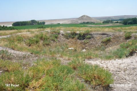 |
|
Type:
|
Mound |
|
Altitude:
|
1185 m |
|
Region:
|
Central Anatolia |
|
Province:
|
Yozgat |
|
District:
|
Bogazliyan |
|
Village:
|
Yogunhisar |
|
Investigation Method:
|
Survey |
|
Period:
|
|
|
|
|
 |
|
| It is situated to the east of the Yogunhisar Village in the Bogazliyan District of Yozgat. It has a base diameter of 340 m, and a height of 24.5 m. It was investigated during the Central Anatolian Survey conducted under the direction of S. Omura in 1990. In addition to the Classic Age sherds, sherds dating to the EBA, MBA, LBA and Iron Age were collected. It takes place in the registered archaeological sites list prepared by Ministry of Culture and Tourism. |
| Location: |
| Geography and Environment: |
| History: |
| Research and Excavation: |
| Stratigraphy: |
| Small Finds: |
| Remains: |
| Interpretation and Dating: |