|
©The Archaeological Settlements of Turkey - TAY Project
|
|
|
|
|
|
Ioniapolis |
|
|
For site maps and drawings please click on the picture... 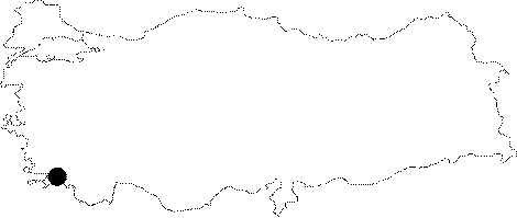 |
For photographs please click on the photo...  |
|
Type:
|
City |
|
Altitude:
|
m |
|
Region:
|
Aegean |
|
Province:
|
Mugla |
|
District:
|
Milas |
|
Village:
|
Gölyaka |
|
Investigation Method:
|
Survey |
|
Period:
|
Roman Hellenistic Classical Archaic |
|
|
|
  |
|
| Location: It is presumed to be located on the southern bank of the Bafa Lake; near the Pinarcik Upland and Mersinet Iskelesi. It is a neighbour of Heracleia under Latmos [Bingöl 2004:25]. |
| Geography and Environment: |
| History: |
| Research and Excavation: A survey was carried out in 1970s by Peschlow. |
| Stratigraphy: |
| Small Finds: |
| Remains: First it was presumed to have been located to the southeast of the Gulf of Latmos while Peschlow suggested that it was situated on the peninsula to the east of the Byzantian Fortress. Traces of walls from the settlement of the Late Classical or Early Christianity Period are observed [Peschlow 1976:40]. With its very contradictory location; the approximation was based on three inscriptions found in Miletus; including the isopoliteia treaty between Miletus and Heracleia; the sympoliteia treaty between Miletus and Pidasa and a building inscription for Didyma. They are all dated to the 2nd century BC; and indicate that the southeast of the Gulf of Latmos is the most convenient place for Ioniapolis [Peschlow 1978b:131]. It is known that the city had a harbor; and a regular sea transportation; which also Heracleia benefited from [Peschlow 1978b:131]. According to Robert and Müller; there is a settlement at the Mersinet Iskelesi while Cook refers to a road network constructed in accordance with the sympoliteia between Pidasa and Miletus. The presence of a road leading from the sea to the inland is known. The main objective of the road costruction was to transport the goods safely from Pidasa to Miletus. The previous road was under the control of Heracleia. Cook suggested that Ioniapolis might have been the Island of Kahveasar; which lies to the west of Mersinet Iskelesi. Many incomplete marble pedestals and drums of columns were found in the water on the southern shore of the present lake; to the west of Mersinet Iskelesi and further the Island of Kahveasar. The dimensions of the pedestal and drums are similar to the ones in the Temple of Apollo in Didyma. The inscription related with construction in Didyma records that the stones were derived from the quarry at Ioniapolis; and then transferred to Panormos; to the northwest of Didyma. These pedestals contribute to approximate the location of the city and the quarry [Peschlow 1978b:133-134]. It is suggested that the initiation and completion of the construction in Didyma might have been closely associated with the foundation and abandonment of Ioniapolis. Thus; history of Ioniapolis may go back to the Archaic Period. The column drums revealed that the quarry served until the Roman Imperial Period. The Gulf of Latmos became a lake in the 4th century AD; probably resulting in losing her significance for Ioniapolis [Peschlow 1978b:134-135]. A fortress located to the east of Dilburun indicates that the settlement was also occupied during the Byzantine Period [Peschlow 1978b:135-136]. |
| Interpretation and Dating: |

