| ©The Archaeological Settlements of Turkey - TAY Project | ||||||
|
|
||||||
Hallan Çemi Tepesi |
||||||
|
|
||||||
| Ages | Maps | Photos | ||||
| Neolithic 14C |
 |
 |
||||
|
|
||||||
|
Type:
|
Mound | |||||
|
Altitude:
|
670 m | |||||
|
Diameter:
|
m- Direction: | |||||
|
|
||||||
|
Region:
|
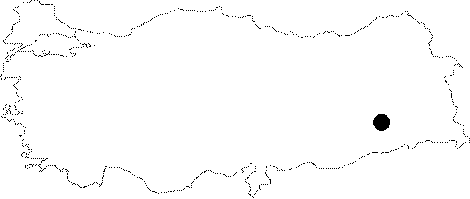
Southeastern Anatolia | |||||
|
Province:
|
Batman | |||||
|
District:
|
Kozluk | |||||
|
Village:
|
Kaletepe | |||||
|
|
||||||
|
Destruction :
|
Dams | |||||
|
|
||||||
|
TAYEx:
|
Not visited - 16/9/2001 | |||||
|
|
||||||
|
Registration State:
|
Registered For detailed registration information please refer to Turkish pages. | |||||
 |
||||||
| Location: This site lies in Kaletepe Village of Kozluk District 50 km north of Batman. |
| Geography and Environment: The site is on a Late Pleistocene terrace in the narrow Sason Stream Valley; on the western bank of this stream. The Sason Stream; which springs from the Taurus mountain chain; is a tributary of the Tigris. Hallan Çemi is a gently rising 4.3 m high mound which covers an area of 7 hectares. |
| Destruction Details: Hallan Çemi Tepesi is partly flooded today [TAYEx 16.9.2001]. |