| ©The Archaeological Settlements of Turkey - TAY Project | ||||||
|
|
||||||
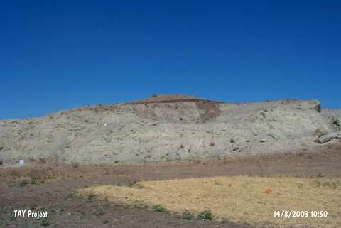
Hamzanin Çal |
||||||
|
|
||||||
| Ages | Maps | Photos | ||||
| EBA |
 |
 |
||||
|
|
||||||
|
Type:
|
Upland Settlement | |||||
|
Altitude:
|
710 m | |||||
|
Diameter:
|
m- Direction: | |||||
|
|
||||||
|
Region:
|
Black Sea | |||||
|
Province:
|
Tokat | |||||
|
District:
|
Zile | |||||
|
Village:
|
Büyüközlü | |||||
|
|
||||||
|
Destruction :
|
Contemporary Settlements | |||||
|
|
||||||
|
TAYEx:
|
Visited - 14/8/2003 | |||||
|
|
||||||
|
Registration State:
|
For detailed registration information please refer to Turkish pages. | |||||
 |
||||||
| Location: |
| Geography and Environment: |
| Destruction Details: Soil has been taken from the skirts of the hill which the site is located on; due to use for making the motorway [TAYEx 14.8.2003]. |