| ©The Archaeological Settlements of Turkey - TAY Project | ||||||
|
|
||||||
Alan Höyük |
||||||
|
|
||||||
| Ages | Maps | Photos | ||||
| Neolithic |
 |
 |
||||
|
|
||||||
|
Type:
|
Mound | |||||
|
Altitude:
|
1070 m | |||||
|
Diameter:
|
m- Direction: | |||||
|
|
||||||
|
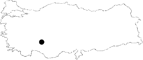
Region:
|
Central Anatolia | |||||
|
Province:
|
Konya | |||||
|
District:
|
Beysehir | |||||
|
Village:
|
Merkez | |||||
|
|
||||||
|
Destruction :
|
Illicit Digging - Agriculture - Highways, roads, bridges etc. | |||||
|
|
||||||
|
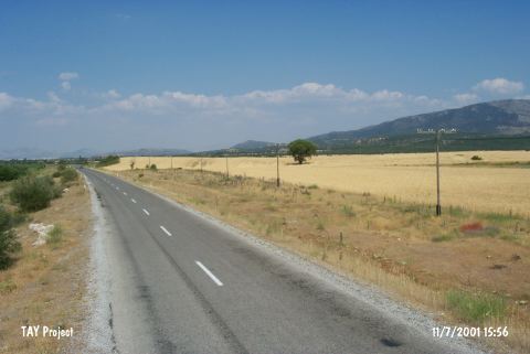
TAYEx:
|
Visited - 11/7/2001 | |||||
|
|
||||||
|
Registration State:
|
For detailed registration information please refer to Turkish pages. | |||||
 |
||||||
| Location: This site lies south of the Beysehir-Akseki highway; 3 km west of the village of Karadiken; west of the town of Beysehir; southwest of the city of Konya. |
| Geography and Environment: The northern part of the mound; which once lay on the narrow plain immediately south of Beysehir Lake; is now beneath the Beysehir-Akseki highway. This destruction exposed a small cross section of the mound. The streamlets that spring from Mount Ovacik water this plain. The mound lies on a natural 700x250 m wide hillock. There is a swamp in the area formed by the abundant water sources. The mound is approximately 100 m in diameter and 3.5-4 m high. Although there is probably a local name for the mound; we have chosen to abide by the name "Alan Höyük"; given by the discoverer; Alan Hall. |
| Destruction Details: The mound has been damaged due to agricultural activities; illicit diggings and the road cutting its northern skirt. There is 2 m high profile on northern part; which caused by soil removal. There are pits on north and east slopes of the mound [TAYEx 11.7.2001]. |