| ©The Archaeological Settlements of Turkey - TAY Project | ||||||
|
|
||||||
Kaklik Mevkii |
||||||
|
|
||||||
| Ages | Maps | Photos | ||||
| EBA |
 |
 |
||||
|
|
||||||
|
Type:
|
Flat Settlement and Cemetery | |||||
|
Altitude:
|
1135 m | |||||
|
Diameter:
|
m- Direction: | |||||
|
|
||||||
|
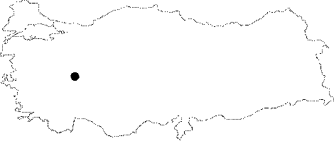
Region:
|
Aegean | |||||
|
Province:
|
Afyonkarahisar | |||||
|
District:
|
Merkez | |||||
|
Village:
|
Burhaniye | |||||
|
|
||||||
|
Destruction :
|
Agriculture | |||||
|
|
||||||
|
TAYEx:
|
Visited - 3/10/2000 | |||||
|
|
||||||
|
Registration State:
|
For detailed registration information please refer to Turkish pages. | |||||
 |
||||||
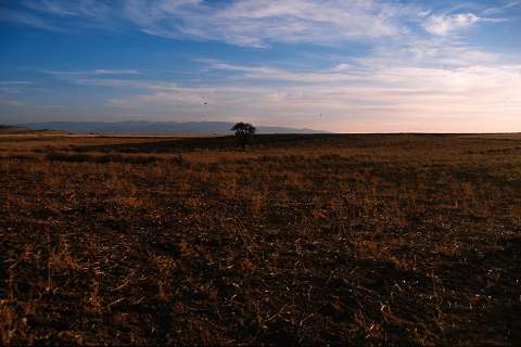
| Location: It lies 1.2 km southwest of the Burhaniye (Kocakir) Village; north-northeast of the Afyonkarahisar Province [Topbas et al. 1998:fig.1]. |
| Geography and Environment: It is a flat settlement located in the area known as Kaklik Mevkii; in the middle of flat cultivated lands. |
| Destruction Details: The settlement is being damaged due to agricultural activities [TAYEx 3.10.2000]. |