| ©The Archaeological Settlements of Turkey - TAY Project | ||||||
|
|
||||||
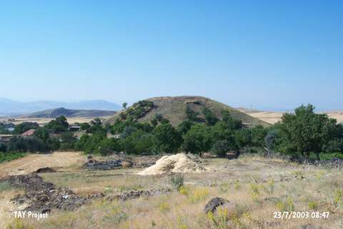
Karahöyük |
||||||
|
|
||||||
| Ages | Maps | Photos | ||||
| Chalcolithic EBA |
 |
 |
||||
|
|
||||||
|
Type:
|
Mound | |||||
|
Altitude:
|
1150 m | |||||
|
Diameter:
|
172 m- Direction: NW-SE | |||||
|
|
||||||
|
Region:
|
Eastern Anatolia | |||||
|
Province:
|
Malatya | |||||
|
District:
|
Arguvan | |||||
|
Village:
|
Karahöyük | |||||
|
|
||||||
|
Destruction :
|
Agriculture - Contemporary Settlements | |||||
|
|
||||||
|
TAYEx:
|
Visited - 23/7/2003 | |||||
|
|
||||||
|
Registration State:
|
Registered For detailed registration information please refer to Turkish pages. | |||||
 |
||||||
| Location: |
| Geography and Environment: |
| Destruction Details: The mound has been damaged by agricultural activities and contemporary settlement. The south-southwest skirt has been cultivated and houses built on northeast skirt [TAYEx 23.7.2003]. |