| ©The Archaeological Settlements of Turkey - TAY Project | ||||||
|
|
||||||
Kildara |
||||||
|
|
||||||
| Ages | Maps | Photos | ||||
| Greek-Roman |
 |
 |
||||
|
|
||||||
|
Type:
|
City | |||||
|
Altitude:
|
m | |||||
|
Diameter:
|
m- Direction: | |||||
|
|
||||||
|
Region:
|
Aegean | |||||
|
Province:
|
Mugla | |||||
|
District:
|
Milas | |||||
|
Village:
|
Kuzyaka | |||||
|
|
||||||
|
|
||||||
|
|
||||||
|
TAYEx:
|
- | |||||
|
|
||||||
|
Registration State:
|
For detailed registration information please refer to Turkish pages. | |||||
 |
||||||
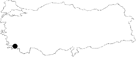
| Location: It is located on the 490 m high Asar mountain; 5 km north-northeast of the Kuzyaka Village; south of the Milas District of the Mugla Province. It is at a 2 km walking distance to the east-southeast of the Sigirtmac fortress. |
| Geography and Environment: The Asar Mountain where the city is situated on; is a flat mountain [Tirpan 1999b:466]. |
| Destruction Details: |