| ©The Archaeological Settlements of Turkey - TAY Project | ||||||
|
|
||||||
Kayabasi |
||||||
|
|
||||||
| Ages | Maps | Photos | ||||
| Neolithic Chalcolithic EBA IA |
 |
 |
||||
|
|
||||||
|
Type:
|
Mound | |||||
|
Altitude:
|
670 m | |||||
|
Diameter:
|
m- Direction: | |||||
|
|
||||||
|
Region:
|
Black Sea | |||||
|
Province:
|
Kastamonu | |||||
|
District:
|
Araç | |||||
|
Village:
|
Giremez | |||||
|
|
||||||
|
Destruction :
|
Illicit Digging - Agriculture - Attention | |||||
|
|
||||||
|
TAYEx:
|
Visited - 21/9/2003 | |||||
|
|
||||||
|
Registration State:
|
For detailed registration information please refer to Turkish pages. | |||||
 |
||||||
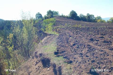
| Location: The site is located in Giremez (Yurttepe) village; northeast of Araç district of Kastamonu. |
| Geography and Environment: It is one of the sites found in the area around the villages which are located at the altitudes up to 850 m in both sides of the Araç stream flowing in the middle of the Araç district. There is a deep sheer cliff on the east-southeast part of the settlement and Giremez stream flows through this cliff. The settlement is located about 20-25 m high from the stream. |
| Destruction Details: Traces of illicit diggings were observed on the highest point of the settlement. The north-northeastern and northwestern sections are being damaged due to cultivation [TAYEx 21.9.2003]. |