| ©The Archaeological Settlements of Turkey - TAY Project | ||||||
|
|
||||||
Oymaagaç Mezarligi |
||||||
|
|
||||||
| Ages | Maps | Photos | ||||
| EBA |
 |
 |
||||
|
|
||||||
|
Type:
|
Cemetery | |||||
|
Altitude:
|
965 m | |||||
|
Diameter:
|
m- Direction: | |||||
|
|
||||||
|
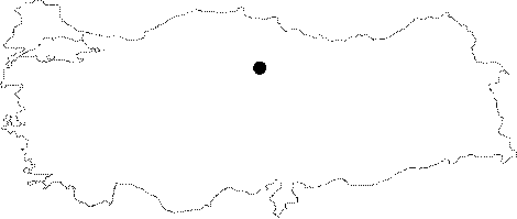
Region:
|
Black Sea | |||||
|
Province:
|
Amasya | |||||
|
District:
|
Merkez | |||||
|
Village:
|
Oymaagaç | |||||
|
|
||||||
|
Destruction :
|
Agriculture | |||||
|
|
||||||
|
TAYEx:
|
Visited - 19/8/2003 | |||||
|
|
||||||
|
Registration State:
|
For detailed registration information please refer to Turkish pages. | |||||
 |
||||||
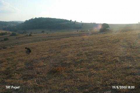
| Location: The cemetery is about 1.5 km northeast of the village of Oymaagaç; located northeast of the Çorum Province. It is accessed through the villages of Karasart; Pinarbasi and Emert from the exit at the 30th km of the Çorum- Merzifon motorway. |
| Geography and Environment: No information was provided about this cemetery. |
| Destruction Details: The settlement is being damaged due to agricultural activities [TAYEx 19.8.2003]. |