| ©The Archaeological Settlements of Turkey - TAY Project | ||||||
|
|
||||||
Sirtlanini Magarasi |
||||||
|
|
||||||
| Ages | Maps | Photos | ||||
| Palaeolithic/Epipalaeolithic |
 |
 |
||||
|
|
||||||
|
Type:
|
Cave | |||||
|
Altitude:
|
160 m | |||||
|
Diameter:
|
m- Direction: | |||||
|
|
||||||
|
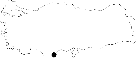
Region:
|
Mediterranean | |||||
|
Province:
|
Mersin | |||||
|
District:
|
Silifke | |||||
|
Village:
|
Tasucu | |||||
|
|
||||||
|
Destruction :
|
Contemporary Settlements - Attention | |||||
|
|
||||||
|
TAYEx:
|
Visited - 12/7/2001 | |||||
|
|
||||||
|
Registration State:
|
For detailed registration information please refer to Turkish pages. | |||||
 |
||||||
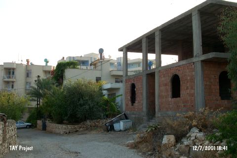
| Location: It is located in Fatih Street of Cumhuriyet Quarter of Tasucu Sub-district; 10.2 km away from Silifke Museum; near the Tasucu Harbor; southwest of both the town of Silifke and the city of Mersin. |
| Geography and Environment: The entrance of the cave; which is about 20-30 m above modern sea level; faces the Tasucu Bay on the Mediterranean Coast. |
| Destruction Details: The hill; under which the cave lies; is covered with modern houses. 14 years ago the mouth of the cave was blown up with dynamite; and filled with rubble. Then the drainage channels of the neighboring houses were debauched into the cave; and buildings were constructed on top of it [TAYEx 12.7.2001]. |