| ©The Archaeological Settlements of Turkey - TAY Project | ||||||
|
|
||||||
S 63/15 |
||||||
|
|
||||||
| Ages | Maps | Photos | ||||
| EBA IA |
 |
 |
||||
|
|
||||||
|
Type:
|
Mound | |||||
|
Altitude:
|
940 m | |||||
|
Diameter:
|
m- Direction: | |||||
|
|
||||||
|
Region:
|
Southeastern Anatolia | |||||
|
Province:
|
Siirt | |||||
|
District:
|
Kurtalan | |||||
|
Village:
|
Gürgöze | |||||
|
|
||||||
|
Destruction :
|
Agriculture - Highways, roads, bridges etc. - Attention | |||||
|
|
||||||
|
TAYEx:
|
Visited - 6/7/2003 | |||||
|
|
||||||
|
Registration State:
|
For detailed registration information please refer to Turkish pages. | |||||
 |
||||||
| Location: |
| Geography and Environment: |
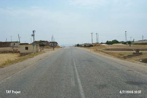
| Destruction Details: The settlement has been cut by the Siirt-Diyarbakir motorway. There are electricity and telephone poles on the site and its southern slope is being cultivated [TAYEx 6.7.2003]. |