| ©The Archaeological Settlements of Turkey - TAY Project | ||||||
|
|
||||||
Hakemi Use Tepe |
||||||
|
|
||||||
| Ages | Maps | Photos | ||||
| Neolithic IA |
 |
 |
||||
|
|
||||||
|
Type:
|
Mound | |||||
|
Altitude:
|
544 m | |||||
|
Diameter:
|
m- Direction: | |||||
|
|
||||||
|
Region:
|
Southeastern Anatolia | |||||
|
Province:
|
Diyarbakir | |||||
|
District:
|
Bismil | |||||
|
Village:
|
Tepe | |||||
|
|
||||||
|
|
||||||
|
|
||||||
|
TAYEx:
|
- | |||||
|
|
||||||
|
Registration State:
|
Registered For detailed registration information please refer to Turkish pages. | |||||
 |
||||||
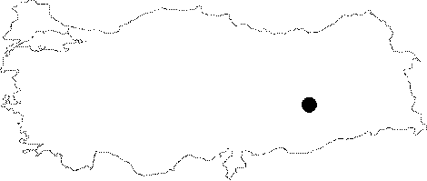
| Location: The site is located in the township of Tepe in the district of Bismil; province of Diyarbakir. It lies on the right bank of the old bed of the Tigris River. |
| Geography and Environment: Hakemi Use Tepe consists of two adjacent mounds. The second mound which was partially destructed due to the agriculture is located approximately 200 m east from the first mound named "Hakemi Use I" where the excavations are performed. This settlement which is almost unnoticed due to the cotton plantation above; measures approximately 80 m in diameter. The settlement known as "Hakemi Use II" contains ceramics of Medieval Ages Period above. The inhabitants of this second settlement apparently used the mound of Hakemi Use I as a cemetery [Tekin 2008:1]. |
| Destruction Details: |