| ©The Archaeological Settlements of Turkey - TAY Project | ||||||
|
|
||||||
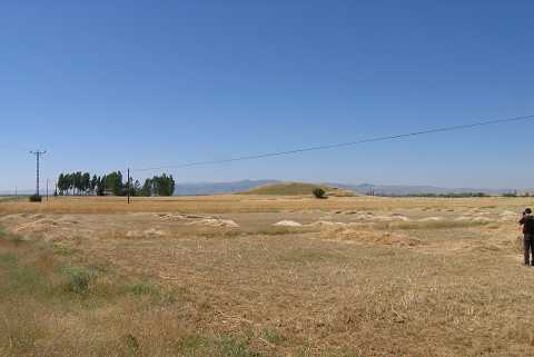
Bagbasi |
||||||
|
|
||||||
| Ages | Maps | Photos | ||||
| Chalcolithic EBA |
 |
 |
||||
|
|
||||||
|
Type:
|
Mound | |||||
|
Altitude:
|
25 m | |||||
|
Diameter:
|
m- Direction: | |||||
|
|
||||||
|
Region:
|
Mediterranean | |||||
|
Province:
|
Antalya | |||||
|
District:
|
Elmali | |||||
|
Village:
|
Bagbasi | |||||
|
|
||||||
|
|
||||||
|
|
||||||
|
TAYEx:
|
Not visited - | |||||
|
|
||||||
|
Registration State:
|
For detailed registration information please refer to Turkish pages. | |||||
 |
||||||
| Location: It is located 1.5 km east of the Korkuteli-Elmali road; 7 km east-northeast of Elmali; southwest of Antalya. |
| Geography and Environment: The mound lies on the edge of a natural hill overlooking the Elmali plain. The western side of the hill is lower than the plain level while the eastern side is higher. There is a stream on the northern section that flows even in summer. The surface of the settlement is mixed by plowing. In the southern section of the well-watered plain are the Karagöl Sazligi and Avlan Lake which are almost dried. |
| Destruction Details: |