| ©The Archaeological Settlements of Turkey - TAY Project | ||||||
|
|
||||||
Boynuzluin |
||||||
|
|
||||||
| Ages | Maps | Photos | ||||
| Chalcolithic |
 |
 |
||||
|
|
||||||
|
Type:
|
Cave | |||||
|
Altitude:
|
270 m | |||||
|
Diameter:
|
m- Direction: | |||||
|
|
||||||
|
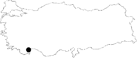
Region:
|
Mediterranean | |||||
|
Province:
|
Antalya | |||||
|
District:
|
Merkez | |||||
|
Village:
|
Yagca | |||||
|
|
||||||
|
Destruction :
|
Natural causes | |||||
|
|
||||||
|
TAYEx:
|
Visited - 20/6/2001 | |||||
|
|
||||||
|
Registration State:
|
For detailed registration information please refer to Turkish pages. | |||||
 |
||||||
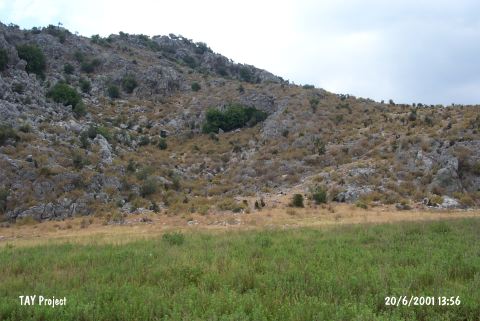
| Location: The site lies 30-31 km north-northwest of Antalya; 1 km northeast of Karain Cave; approximately 250 m northwest of Öküzini Cave. |
| Geography and Environment: The cave; very close to Kirkgöz Springs and 45 m high above the level of the plain; formed naturally on the eastern slopes of Katran Mountain. Its mouth; closed today; looks towards east. It is; therefore; very appropriate for a settlement. The cave consists of three galleries and a very small entrance. This first entrance leads to the main mouth of the cave. The second gallery is the main living room. This space is divided by a drystone wall. These walls became cemented in time because of the dropping lime water; and formed into a big platform. The western part of the 2nd gallery; called "a"; has a 25-30 cm thick deposit. The third gallery at the back; consisting of stalactites and crystals; is higher than the level of the cave; and seems like a balcony. This gallery was not inhabited. In addition; small indentations; belonging to the 2nd gallery; were observed. |
| Destruction Details: The mouth of the cave has been collapsed due to natural causes [TAYEx 20.6.2001]. |