| ©The Archaeological Settlements of Turkey - TAY Project | ||||||
|
|
||||||
Buruncuk / Larisa |
||||||
|
|
||||||
| Ages | Maps | Photos | ||||
| EBA IA |
 |
 |
||||
|
|
||||||
|
Type:
|
Flat Settlement | |||||
|
Altitude:
|
90 m | |||||
|
Diameter:
|
m- Direction: | |||||
|
|
||||||
|
Region:
|
Aegean | |||||
|
Province:
|
Izmir | |||||
|
District:
|
Menemen | |||||
|
Village:
|
Buruncuk | |||||
|
|
||||||
|
|
||||||
|
|
||||||
|
TAYEx:
|
Visited - 17/9/2000 | |||||
|
|
||||||
|
Registration State:
|
Registered For detailed registration information please refer to Turkish pages. | |||||
 |
||||||
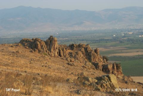
| Location: It is located at the Buruncuk Village of the Menemen District, 28 km north of the provincial center of Izmir [Sevin 2001a:260]. |
| Geography and Environment: The Buruncuktepe on which the city of Larisa is located is the upper plain of a small nose like hill rising to the right after passing through the Gediz River. Buruncuktepe overlooks the Menemen Plain in all directions [Doger 1998:279]. |
| Destruction Details: |