| ©The Archaeological Settlements of Turkey - TAY Project | ||||||
|
|
||||||
Cendere Magarasi |
||||||
|
|
||||||
| Ages | Maps | Photos | ||||
| Neolithic EBA |
 |
 |
||||
|
|
||||||
|
Type:
|
Cave | |||||
|
Altitude:
|
500 m | |||||
|
Diameter:
|
m- Direction: | |||||
|
|
||||||
|
Region:
|
Southeastern Anatolia | |||||
|
Province:
|
Adiyaman | |||||
|
District:
|
Kahta | |||||
|
Village:
|
Kilisik | |||||
|
|
||||||
|
|
||||||
|
|
||||||
|
TAYEx:
|
Visited - 26/9/2001 | |||||
|
|
||||||
|
Registration State:
|
Registered For detailed registration information please refer to Turkish pages. | |||||
 |
||||||
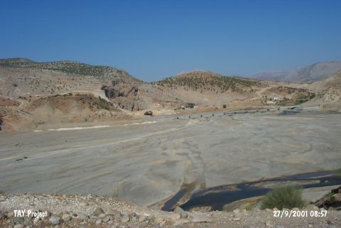
| Location: This site is 35 km northeast of the city of Adiyaman; near the Cendere Bridge which spans across Cendere Stream; a branch of Kahta Stream. On a 1:100;000 map; on map section M 41; there are numerous symbols indicating the presence of caves on the southern slopes of the rock outcrops northwest of the bridge and the northern slopes of the rock outcrop west of the bridge. It is possible to easily reach this site via the asphalt highway to Kahta and Nemrut Dag. |
| Geography and Environment: The cave is small and lies northwest of the Roman Bridge which still being used and spanning over the Cendere Stream (Chabines Flumen; in antiquity). The exact location has not been reported. The dimensions of the cave have not been reported. |
| Destruction Details: |