| ©The Archaeological Settlements of Turkey - TAY Project | ||||||
|
|
||||||
Abdullahin Düzü |
||||||
|
|
||||||
| Ages | Maps | Photos | ||||
| Chalcolithic |
 |
 |
||||
|
|
||||||
|
Type:
|
Mound | |||||
|
Altitude:
|
510 m | |||||
|
Diameter:
|
m- Direction: | |||||
|
|
||||||
|
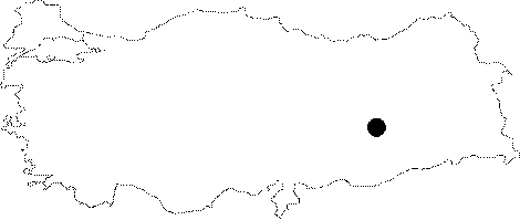
Region:
|
Southeastern Anatolia | |||||
|
Province:
|
Diyarbakir | |||||
|
District:
|
Bismil | |||||
|
Village:
|
Salat | |||||
|
|
||||||
|
Destruction :
|
Agriculture | |||||
|
|
||||||
|
TAYEx:
|
Visited - 10/9/2001 | |||||
|
|
||||||
|
Registration State:
|
For detailed registration information please refer to Turkish pages. | |||||
 |
||||||
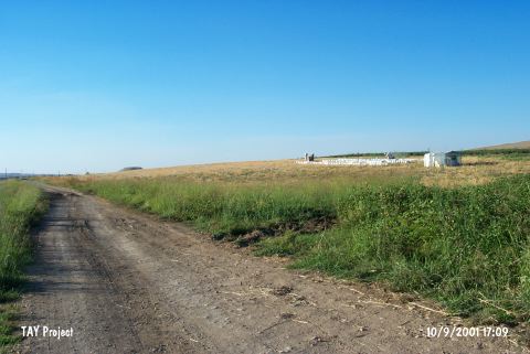
| Location: The site lies east of Diyarbakir; between Bismil and Batman. It is located 2.1 km away from Yukarisalat while going towards Salat; immediately northeast of the dirt road. Abdullahin Düzü is not shown on the 1:100000 Mardin M 45 map. Salat Stream joins with Tigris without meander; on Algaze's map. |
| Geography and Environment: The 1-2 m high; round and broad mound; 100 m in diameter; is located on the eastern bank of Salat Stream; on the northern bank of Tigris; close to the junction of Salat Stream and Tigris; above the lower terrace of overflowing plain of Tigris. The mound is slightly damaged because of being plowed. Due to the distribution of pottery it covers an area of 1-2 hectares. |
| Destruction Details: The site is being destructed by agricultural activities [TAYEx 10.9.2001]. |