| ©The Archaeological Settlements of Turkey - TAY Project | ||||||
|
|
||||||
Çalca Mevkii |
||||||
|
|
||||||
| Ages | Maps | Photos | ||||
| Neolithic |
 |
 |
||||
|
|
||||||
|
Type:
|
Artifact Scatter | |||||
|
Altitude:
|
156 m | |||||
|
Diameter:
|
m- Direction: | |||||
|
|
||||||
|
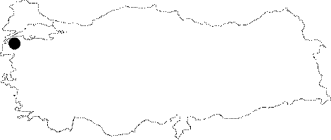
Region:
|
Marmara | |||||
|
Province:
|
Çanakkale | |||||
|
District:
|
Çan | |||||
|
Village:
|
Karli | |||||
|
|
||||||
|
|
||||||
|
|
||||||
|
TAYEx:
|
Visited - 30/6/2000 | |||||
|
|
||||||
|
Registration State:
|
For detailed registration information please refer to Turkish pages. | |||||
 |
||||||
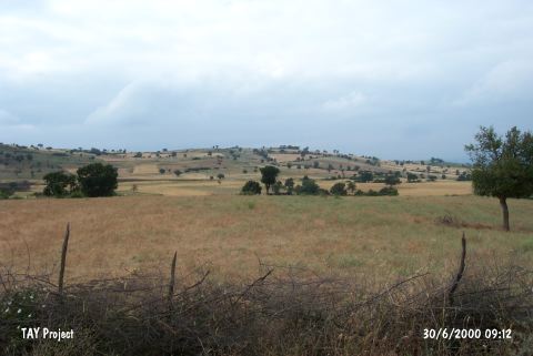
| Location: This site lies east of the city of Çanakkale; 8 km west of the city of Çan and 1 km south of the village of Karliköy; between the village and the village road. The survey code of the site is H 4 / 1. |
| Geography and Environment: The site was discovered during the careful foot-survey conducted in the region on the Kocadere and Karlidere terraces; in the region of the Karliköy and Ilyasaga farms; north of the Çan Plain. Chipped stone tool finds were scattered in the 10.000x500 m region surveyed along the stream. The survey indicated that the left bank of Karlidere Stream yielded a concentration of finds in a 300x200 m area known as Çalca Mevkii [Özdogan 1990b:447-449]. West of this; on the lower terrace; several chipped stone cores; core fragments and debitage products were found. In his 1991 article; however;Özdogan notes that the area that yielded ceramic finds is only 30x40 m in size [Özdogan 1991:347]. Özdogan notes that the site of Çalca Mevkii was a temporary habitation area and not a long term settlement [Özdogan 1990a]. The region must have had some desirable resources such as raw materials or water sources. |
| Destruction Details: |