| ©The Archaeological Settlements of Turkey - TAY Project | ||||||
|
|
||||||
Akarçay Höyük |
||||||
|
|
||||||
| Ages | Maps | Photos | ||||
| Chalcolithic EBA |
 |
 |
||||
|
|
||||||
|
Type:
|
Mound | |||||
|
Altitude:
|
357 m | |||||
|
Diameter:
|
m- Direction: | |||||
|
|
||||||
|
Region:
|
Southeastern Anatolia | |||||
|
Province:
|
Sanliurfa | |||||
|
District:
|
Birecik | |||||
|
Village:
|
Akarçay | |||||
|
|
||||||
|
|
||||||
|
|
||||||
|
TAYEx:
|
Not visited - 2/9/2001 | |||||
|
|
||||||
|
Registration State:
|
Registered For detailed registration information please refer to Turkish pages. | |||||
 |
||||||
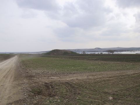
| Location: This site is 900 m Southeast of Akarçay Village that is approximately 15 km South of Birecik Suburb of Sanliurfa City. |
| Geography and Environment: The site is on a terrace which is possibly created in Late Pleistocene Age overlooking Euphrates River Bed and it is 180 m between North and East Edges, and 160 m between East and West. The summit of the mound is 357 m of altitude. Its North slope is steep and other directions are slopped in benches. |
| Destruction Details: |