| ©The Archaeological Settlements of Turkey - TAY Project | ||||||
|
|
||||||
Demircitepe / Demirköy |
||||||
|
|
||||||
| Ages | Maps | Photos | ||||
| Neolithic |
 |
 |
||||
|
|
||||||
|
Type:
|
Mound | |||||
|
Altitude:
|
520 m | |||||
|
Diameter:
|
m- Direction: | |||||
|
|
||||||
|
Region:
|
Southeastern Anatolia | |||||
|
Province:
|
Diyarbakir | |||||
|
District:
|
Silvan | |||||
|
Village:
|
Demirkuyu | |||||
|
|
||||||
|
Destruction :
|
Agriculture - Attention | |||||
|
|
||||||
|
TAYEx:
|
Visited - 16/9/2001 | |||||
|
|
||||||
|
Registration State:
|
For detailed registration information please refer to Turkish pages. | |||||
 |
||||||
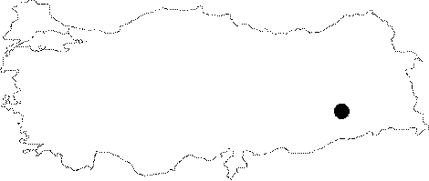
| Location: This site lies northeast of the city of Batman; on the eastern part of the Demircitepe hill in Demirkuyu (Demirköy/Demirciler) Village. The mound is referred to both as Demircitepe and as Demirci Höyük. Yakar calls it Demirci Tepe. In the most recent publication the mound is referred to as Demirköy Höyügü. |
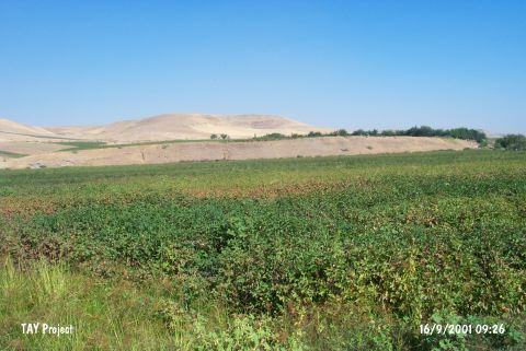
| Geography and Environment: The eastern part of the site; which lies on the western bank of Batman Stream; a tributary of the Tigris; was cut by this stream. The exposed cross-section revealed that there was a 7 m deep cultural depositional layer at the site. On the mound; which has been partially buried under the alluvial deposit from the nearby plateau; cotton plant is cultivated. Because of the intense cultivation; the dimensions of the site could not be determined. The surface collection was mainly concentrated along the streams. |
| Destruction Details: The site of Demircitepe / Demirköy is destructed by agricultural activities. This area is being used as cotton field [TAYEx 16.9.2001]. |