| ©The Archaeological Settlements of Turkey - TAY Project | ||||||
|
|
||||||
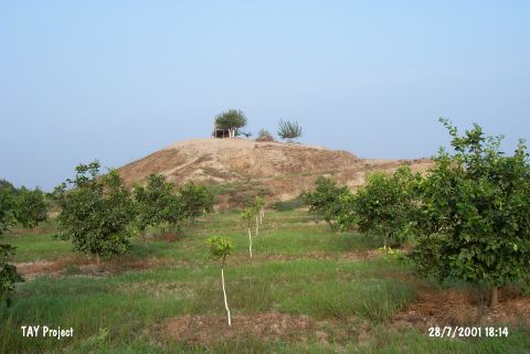
Dervisli |
||||||
|
|
||||||
| Ages | Maps | Photos | ||||
| Chalcolithic EBA IA |
 |
 |
||||
|
|
||||||
|
Type:
|
Mound | |||||
|
Altitude:
|
70 m | |||||
|
Diameter:
|
m- Direction: | |||||
|
|
||||||
|
Region:
|
Mediterranean | |||||
|
Province:
|
Adana | |||||
|
District:
|
Seyhan | |||||
|
Village:
|
Dervisler | |||||
|
|
||||||
|
Destruction :
|
Illicit Digging - Agriculture - Attention | |||||
|
|
||||||
|
TAYEx:
|
Visited - 28/7/2001 | |||||
|
|
||||||
|
Registration State:
|
For detailed registration information please refer to Turkish pages. | |||||
 |
||||||
| Location: |
| Geography and Environment: |
| Destruction Details: The mound has been damaged due to agricultural activities and illicit diggings. Soil removed from all of its skirts and then leveled for making way for fields. There is a big pit on northwest section [TAYEx 28.7.2005]. |