| ©The Archaeological Settlements of Turkey - TAY Project | ||||||
|
|
||||||
Girharrin / Gülharrin |
||||||
|
|
||||||
| Ages | Maps | Photos | ||||
| EBA IA |
 |
 |
||||
|
|
||||||
|
Type:
|
Mound | |||||
|
Altitude:
|
450 m | |||||
|
Diameter:
|
m- Direction: | |||||
|
|
||||||
|
Region:
|
Southeastern Anatolia | |||||
|
Province:
|
Mardin | |||||
|
District:
|
Yesilli | |||||
|
Village:
|
Ortaköy | |||||
|
|
||||||
|
Destruction :
|
Contemporary Settlements - Attention | |||||
|
|
||||||
|
TAYEx:
|
Visited - 22/9/2001 | |||||
|
|
||||||
|
Registration State:
|
Registered For detailed registration information please refer to Turkish pages. | |||||
 |
||||||
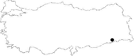
| Location: It lies in the center of the village of Ortaköy (Girharrin) Village located immediate west of the Mardin-Nusaybin motorway; 11 km south-southeast of the Mardin Province [Ay 1995:map at 27]. |
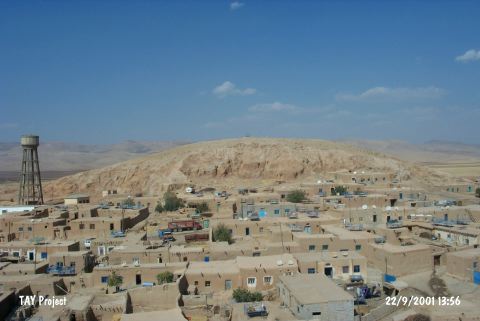
| Geography and Environment: It measures 40 m in height above the plain level and 400x300 m in dimensions including the terraces. The cone of the mound measures 75x70 m. It has an oval shape. It is located on the western bank of the Rijli Stream. The valley of Navala Kutte; where the mound is located at the entry; provides a natural alley to the northeast. It is close to the road called King's Road. The mound has been severely destroyed by the local villagers and treasure hunters. The name is suggested to derive from Gir (hill) and Harrin (road). It is claimed that the city of Huzirina mentioned in the Assyrian documents is located here. |
| Destruction Details: The mound of Girharrin / Gülharrin is destructed by the contemporary settlement. There is a place where a holy man is buried on top and on skirts houses take place. The water reservoir of the village is on west skirt of the mound and a serious amount of soil taken away from all slopes of the mound [TAYEx 22.9.2001]. |