|
|
||||
|
|
||||
|
Koyunbaba |
||||
|
For cave maps and drawings please click on the picture... |
For photographs please click on the photo... |
|||
|
 |
|||
|
Type: |
Horizontal Cave | |||
|
Altitude: |
140 m | |||
|
Depth: |
-15 m | |||
|
Length: |
532 m | |||
|
Region: |
Marmara | |||
|
Province: |
Kirklareli | |||
|
District: |
Merkez | |||
|
Village: |
Koyunbaba | |||
|
|
||||
 |
||||
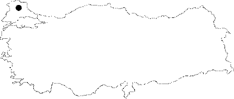
| Location: It lies on the right slope of the Teke Creek originating from the Kayali Dam; 3 km north the Koyunbaba Village; 15 km southwest of Kirklareli. It is located on a stabilized road deviating to Koyunbaba from the Teke Creek at 9th km of the road running from Kirklareli to Kayaliköy. |
| Structural Properties and formation : It is a fossil cave which was formed within the Eocene limestones over a pronounced fault line. It has three entrances; the main entrance is 20 m high from the valley; the second one is located at +13 m and the second one at +5.5 m in respect to the main entrance. Initially elongating in the northwest-southeast directions; it changed its direction in the mid where the second entrance is located toward north-south. At this point of change; a big depression hall of 50x60 m with a roof height of 30 m was developed. |
| Research History: It was explored and mapped by MTA. |
| Findings: The most remarkable forms of life is bats. With a big colony inhabiting almost all part of the cave; they are mainly concentrated in the small rooms ahead of the main entrance and the big depression hall. Thus; big masses of guano are found in these sections. |