|
|
||||
|
|
||||
|
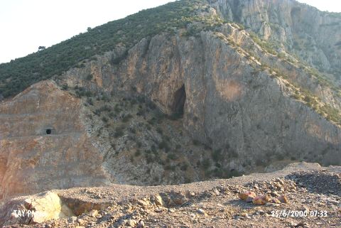
Inbogazi Magaralari |
||||
|
For cave maps and drawings please click on the picture... |
For photographs please click on the photo... |
|||
|
 |
|||
|
Type: |
Cave | |||
|
Altitude: |
120 m | |||
|
Depth: |
m | |||
|
Length: |
m | |||
|
Region: |
Marmara | |||
|
Province: |
Balikesir | |||
|
District: |
Havran | |||
|
Village: |
Inönü | |||
|
|
||||
 |
||||

| It is a cave formation with seven mouths at Inbogazi Mevkii of the Cal Mountain; 1.5 km Southeast of Balikesir. They were found by K. Kökten in 1949; and they have names such as Devedami; Karanlik; Aydinlik and Andik. K. Kökten conducted an excavation in the Karanlik Cave; the largest one among all; and dated the black and brown burnished potsherds with incised decorations to the Chalcolithic; even to the Neolithic Age. It was revisited by M. Ozdogan in 1987; and listed as a settlement from the Chalcolithic; EBA and Middle Ages [Harmankaya et al. 1998]. |
| Location: It is located 1500 m behind the village of Inönü; 6 km east of the Havran District; west of the Balikesir Province. |
| Structural Properties and formation : |
| Research History: |
| Findings: |