|
©The Archaeological Settlements of Turkey - TAY Project
|
|
|
|
|
 |
Iznik Seyh Bedrettin Sokak'taki Kilise |
|
|
|
|
For site maps and drawings please click on the picture... 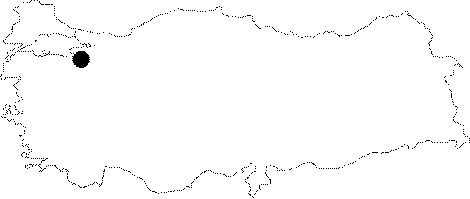 |
For photographs please click on the photo... 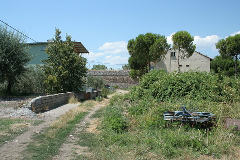 |
|
|
|
|
Type:
|
Church |
|
Plan Type:
|
Basilica |
|
Year of Costruction:
|
|
|
Phase:
|
|
|
Investigation Method:
|
Excavation |
|
Altitude:
|
93 |
|
|
|
|
Region:
|
Marmara |
|
Province:
|
Bursa |
|
District:
|
Iznik |
|
Village:
|
M. Kemal Pasa Mah. |
|
Antique Name:
|
Nicaia |
|
|
|
  |
|
| Location: It is located on the Seyh Bedrettin Street in the Mustafa Kemal Pasa Quarter of the Iznik District in Bursa. The Seyh Bedrettin Street is to the northeast Iznik Walls are 45 m west, Kafkas Street is to the east and Bagkur Housing Complex is just south [TAYEx 26.07.2008]. |
| Geography and Environment: It lies near the city walls to the northwest of the district. Other remains nearby on Arabaci Street known as "Iznik'teki Altyapi" (the Substructure at Iznik) also belong to Byzantine Period. The remains of the church on Seyh Bedrettin Street are approximately 150 m northeast of "Iznik'teki Altyapi". To the southeast of the building are the remains of a wall revealed during a sounding, and semicircular niches in the southwest. Also found nearby are water channels from the Roman Period. Some parts of the remains had been destructed during the construction of the residences that surround the building. Once surrounded by wires, they remain neglected. |
| Research and Excavation: It was found by the excavation team of the Iznik Tile Kilns in 1987 [Aslanapa 1989:258]. The excavations started in 1988, and continued between 1991 and 1992. It was cleaned of debris and vegetation in 1994. |
| Description: Architectural Features: It has a basilical plan in the east-west direction. The projecting apse of the structure has corners on the outside. To the north are three rooms with collapsed brick vaults, each communicating with other through a door. It seems that they were repeated on the south. These rooms which can be interpreted as the narthex and the nave are from the first phase of the building. The graves located to the west of these remains suggest a second phase. Traces of a wall that belong to a third phase are observed partly on the western section of the building from the first phase [Aslanapa 1994:549]. Remains of a pavement and a wall parallel to the direction of Mecca (kiblah) from the late period are observed to the southeast of the existing building [Aslanapa 1990:363-370, Aslanapa 1993:478, Aslanapa 1994:549]. At present the building is underneath a dense cover of vegetation and only the west and northwest walls are visible. There are other wall remains approximately 20 m southwest of the northwest wall. |
| Finds: Coin: A copper coin from the Roman Empire dating to the period of the Emperor Diocletian (284-305) was found [Aslanapa 1989:279]. |
| Interpretation: Although the building is probably related to the structure on the Arabaci Street based on its location, it is also likely that it might have been related with the Iznik Palace [Aslanapa 1993:478]. |
| Destruction: A 3 m high foundation wall was built over the wall which is 20 m southwest of the northwest wall in 2007. A road crosses over the land which was officially declared protection zone. There is heavy housing development in the environs regardless of the official declaration and the construction work continues. The building is under a dense layer of vegetation. 2 large soundings are observed performed by Iznik Museum inside the construction zone in the southwest of the building complex in 2007. The sherds were left dispersed and uncontrolled around the sounding pits. The soundings were performed regardless of its location right next to the building complex on Seyh Süleyman Street but the court ordered to seize construction. In the mean time the construction goes on regardless of the court order [TAYEx 26.07.2008]. |

