|
©The Archaeological Settlements of Turkey - TAY Project
|
|
|
|
|
|
Gavurtepe Höyük |
|
|
For site maps and drawings please click on the picture...  |
For photographs please click on the photo... 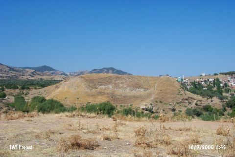 |
|
Type:
|
Mound |
|
Altitude:
|
260 m |
|
Region:
|
Aegean |
|
Province:
|
Manisa |
|
District:
|
Alasehir |
|
Village:
|
Merkez |
|
Investigation Method:
|
Excavation |
|
Period:
|
EBA I EBA II |
|
|
|
 |
|
| Location: It lies southwest of Alasehir District; southeast of the Manisa Province. |
| Geography and Environment: It is located in the fertile terrain on the western bank of the Sarikiz Stream; in the middle of Gediz Plain. The mound lies in the north-south direction and has fairly steep slopes. |
| History: |
| Research and Excavation: The top hill called megaron area on the southern and northern part of the hill were excavated between 1987 and 1992 under R. Meriç. The EBA layers were discovered on the southern part. It was researched by E. Akdeniz et al. in 2007 [Akdeniz 2009:261].It is listed in the registered archaeological inventory of preserved zones prepared by Ministry of Culture and Tourism. It was visited during the survey conducted by A.Y. Tavukçu and his team in 2013 [Tavukçu et al. 2015]. |
| Stratigraphy: The mound houses settlements of the Chalcolithic Age; the second millennium BC; the Hellenistic and Byzantine Periods other than EBA. At the end of the 1992 excavation; 6 building levels were identified in the southern trench. R. Meriç reports that these building levels belong to three main phases [Meriç 1993:355]. |
| Small Finds: Architecture: The 1990 excavation yielded fragments of a wall in the southern trench [Meriç 1992: pic.1]. Two walls are in the same direction. Meriç suggests that these parallel walls probably belong to a megaron-like building. The structures of the building level 5 were collapsed due to earthquakes. An offer room; a ceremony hall and a courtyard were uncovered. The finds recovered from these rooms expose that the building level 5 is a settlement dating from an early phase of EBA [Meriç 1994:423]. Pottery: The building levels 3-4 yielded; mostly in situ; small single handled spouted pitchers [Meriç 1992:227; pic.3-4]; three footed; single handled; spouted and plain coarse kitchen ware; double handled unburnished pithoi and bowls with unrolled rims. One of the spouted pitchers was elaborately produced [Meriç 1992:pic.5]. The black burnished ware increases in quantity through the lower levels. The building level 5 yielded a pithos decorated with incised stylized human figures and swastika. Ground Stone: The Cycladic idol; dating from Troy II; recovered by R. Meriç during the 1987 excavation is in marble [Meriç 1989:158; pic.6]. The 1990 excavation yielded a marble idol and fragment of a marble bowl while the 1991 excavation revealed a violin-shaped idol in marble [Meriç 1993:pic.2]. A 20 cm long marble idol was found in the offer room of the building level 5. Metal: Bronze pins were recovered [Meriç 1989:pic.4] Human Remains: An intramural pithos grave was found in the third phase of the building level 4. It belongs to a 12-14 months old girl. A necklace with 89 golden beads; two golden bracelets; two golden ear plugs; bronze bracelet; violin-shaped idol in marble; stone seal and two spouted pitchers were left as grave goods [Meriç 1993:pic.5]. During the survey conducted by A.Y. Tavukçu in 2013, a masonry grave with a width of 75 cm was discovered in the western section of the mound. The grave was covered with a monolithic stone measuring 125x20 cm. This grave and the other found in Meriç's excavations show that the mound was used as a necropolis during Byzantine Period [Tavukçu et al. 2015:305]. |
| Remains: |
| Interpretation and Dating: Even tough R. Meriç hesitates to date those finds recovered from the southern trench; he reports that the building levels 5 and 4 probably belong to EBA II-I. The presence of sherds comparable with the finds of Troy III-V on the upper level suggests an EBA III settlement while the forms of the vessels demonstrate EBA II. |