| ©The Archaeological Settlements of Turkey - TAY Project | ||||||
|
|
||||||
Gavurtepe Höyük |
||||||
|
|
||||||
| Ages | Maps | Photos | ||||
| EBA |
 |
 |
||||
|
|
||||||
|
Type:
|
Mound | |||||
|
Altitude:
|
260 m | |||||
|
Diameter:
|
m- Direction: | |||||
|
|
||||||
|
Region:
|
Aegean | |||||
|
Province:
|
Manisa | |||||
|
District:
|
Alasehir | |||||
|
Village:
|
Merkez | |||||
|
|
||||||
|
Destruction :
|
Illicit Digging - Natural causes | |||||
|
|
||||||
|
TAYEx:
|
Visited - 16/9/2000 | |||||
|
|
||||||
|
Registration State:
|
Registered For detailed registration information please refer to Turkish pages. | |||||
 |
||||||
| Location: It lies southwest of Alasehir District; southeast of the Manisa Province. |
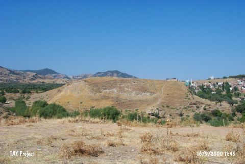
| Geography and Environment: It is located in the fertile terrain on the western bank of the Sarikiz Stream; in the middle of Gediz Plain. The mound lies in the north-south direction and has fairly steep slopes. |
| Destruction Details: The southeastern section of the mound has been severely damaged by an illicit digging pit measuring 10x10 m [TAYEx 16.9.2000]. |