|
©The Archaeological Settlements of Turkey - TAY Project
|
|
|
|
|
|
Güzelova |
|
|
For site maps and drawings please click on the picture... 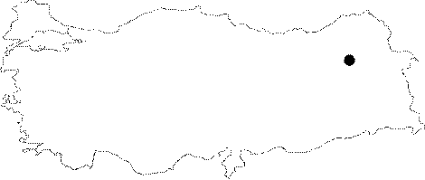 |
For photographs please click on the photo... 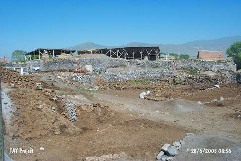 |
|
Type:
|
Mound |
|
Altitude:
|
1780 m |
|
Region:
|
Eastern Anatolia |
|
Province:
|
Erzurum |
|
District:
|
Merkez |
|
Village:
|
Güzelova |
|
Investigation Method:
|
Excavation |
|
Period:
|
|
|
|
|
 |
|
| The mound; measuring 12.5 m in height; lies 15 km northeast of the city of Erzurum; in Güzelova Village. It is easy to reach the site via the road between Erzurum and Tortum. Karasu passes close to the site; which is located on a watery land of Erzurum Plain. An excavation was conducted by H.Z. Kosay and H. Vary in 1961. It was still not possible to reach the virgin soil at the depth of 20 m. According to the excavators; decorated and nondecorated Karaz sherds were found. Therefore; Güzelova is one of the debatable sites for Chalcolithic Age like the settlements of Karaz and Pulur. It may be dating to the end of 4th Millennium BC and to the 3rd Millenium BC. It takes place in the registered archaeological sites list prepared by Ministry of Culture and Tourism. |
| Location: It is located where the village of Güzelova (Tufanç/Tufanli) is situated; south of Dumlu; 15 km north-northeast of Erzurum Province. |
| Geography and Environment: One of the branches of the Euphrates; the Karasu Stream; passes by the south of the mound. The mound is located in a fertile and watery part of the Erzurum Plain. It is 12.5 m high above the plain level. It is noted that the lower levels of the mound are below the plain level because the virgin soil was still not reached at 20 m depth. The eastern part of the mound has been severely damaged; particularly by the foundations of the modern buildings and garbage pits. |
| History: |
| Research and Excavation: |
| Stratigraphy: |
| Small Finds: |
| Remains: |
| Interpretation and Dating: |