| ©The Archaeological Settlements of Turkey - TAY Project | ||||||
|
|
||||||
Güzelova |
||||||
|
|
||||||
| Ages | Maps | Photos | ||||
| Chalcolithic EBA |
 |
 |
||||
|
|
||||||
|
Type:
|
Mound | |||||
|
Altitude:
|
1780 m | |||||
|
Diameter:
|
m- Direction: | |||||
|
|
||||||
|
Region:
|
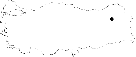
Eastern Anatolia | |||||
|
Province:
|
Erzurum | |||||
|
District:
|
Merkez | |||||
|
Village:
|
Güzelova | |||||
|
|
||||||
|
Destruction :
|
Contemporary Settlements - Attention | |||||
|
|
||||||
|
TAYEx:
|
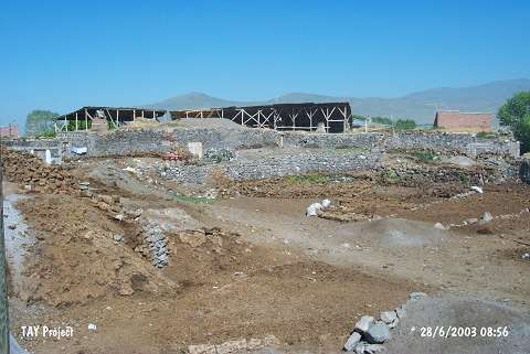
Visited - 28/6/2003 | |||||
|
|
||||||
|
Registration State:
|
Registered For detailed registration information please refer to Turkish pages. | |||||
 |
||||||
| Location: It is located where the village of Güzelova (Tufanç/Tufanli) is situated; south of Dumlu; 15 km north-northeast of Erzurum Province. |
| Geography and Environment: One of the branches of the Euphrates; the Karasu Stream; passes by the south of the mound. The mound is located in a fertile and watery part of the Erzurum Plain. It is 12.5 m high above the plain level. It is noted that the lower levels of the mound are below the plain level because the virgin soil was still not reached at 20 m depth. The eastern part of the mound has been severely damaged; particularly by the foundations of the modern buildings and garbage pits. |
| Destruction Details: The mound has disappeared due to earth removal [TAYEx 28.6.2003]. |