|
©The Archaeological Settlements of Turkey - TAY Project
|
|
|
|
|
|
Höyücek |
|
|
For site maps and drawings please click on the picture...  |
For photographs please click on the photo... 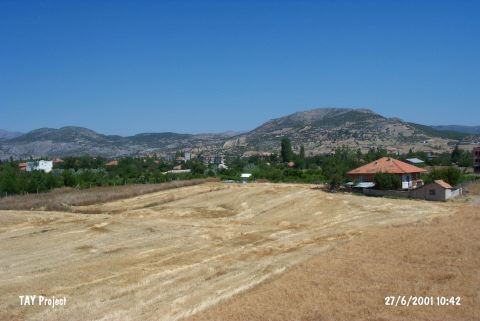 |
|
Type:
|
Mound |
|
Altitude:
|
750 m |
|
Region:
|
Mediterranean |
|
Province:
|
Burdur |
|
District:
|
Bucak |
|
Village:
|
Merkez |
|
Investigation Method:
|
Excavation |
|
Period:
|
|
|
|
|
 |
|
| It lies 250-300 m east of the Burdur - Antalya highway; immediate west of Bucak District; southeast of Burdur Province. Due to the heavy cultivation continued for years; the damage is too much. It has been officially proclaimed as a registered site since it is being surrounded by modern settlements. It was discovered by M. Özsait. The EBA material recovered is very poor. The site was named as Höyük Çeltikçi by D. French and this may be the fact that Korfmann gave two different site numbers to these settlements. It takes place in the registered archaeological sites list prepared by Ministry of Culture and Tourism. |
| Location: This site is located in Kahveler Mevkii of Mimar Sinan quarter of Bucak District; 250-300 m east of Burdur-Antalya highway; southeast of Burdur Province. |
| Geography and Environment: Höyücek is a small and low lying mound which rises 3.5 m above the level of the plain and has a 12 m diameter [Duru 1991a:87; 1992b:552]. |
| History: |
| Research and Excavation: |
| Stratigraphy: |
| Small Finds: |
| Remains: |
| Interpretation and Dating: |