|
©The Archaeological Settlements of Turkey - TAY Project
|
|
|
|
|
|
KM 97 Domuztepe |
|
|
For site maps and drawings please click on the picture... 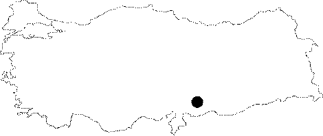 |
For photographs please click on the photo... 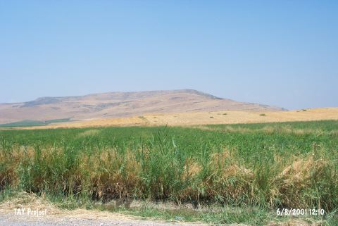 |
|
Type:
|
Mound |
|
Altitude:
|
550 m |
|
Region:
|
Mediterranean |
|
Province:
|
Kahramanmaras |
|
District:
|
Pazarcik |
|
Village:
|
Emiroglu |
|
Investigation Method:
|
Excavation |
|
Period:
|
Ceramic |
|
|
|
 |
|
| Location: The mound lies in Emiroglu Village; southwest of Narli Sub-district; 32 km south-southeast of the centrum of Kahramanmaras. It is labeled KM 97 by Carter (KM being the abbreviation of Kahramanmaras). |
| Geography and Environment: The mound located on the east bank of Aksu River; in Maras Plain Ñan alluvial formation by the river springing out from Kürt MountainsÑ and is surrounded by rich fields convenient for agriculture and animal husbandry. It lies on the natural mountain-pass from north to southeast; in Maras Plain. Therefore it is in an area extremely convenient for settling. The ovoid mound is 12 m higher than the plain level and covers an area of 18 hectares. A series of cores was taken both on and off the site in 2004 and suggests that the area west of the site was a marsh or lake in prehistory [cat.une.edu.au/page/domuztepe 25.7.2006; 10:30]. |
| History: |
| Research and Excavation: It is discovered during the Kahramanmaras Archaeological Survey by E. Carter in 1993 [Carter 1995:334]. The archaeological excavations in Domuztepe Mound were carried out by foreign teams in 1995-2012. In 2008, the excavation were taken over by Stuart Campbell. The last project director Stuart Campbell handed on the project to Halil Tekin from Hacettepe University in 2013 and the 2013-2014 excavations were conducted under the directorship of Kahramanmaras Museum with a team from Hacettepe University. |
| Stratigraphy: |
| Small Finds: Architecture: In 2014, the studies continued in the northeast part of Operation 1 that was excavated by the previous team. Two structures were determined in two new trenches. The studies also continued in this area during the 2015 season. This area is named Area 1 by the new team. It covers an area of about 150 square meters. It is located in the east of the section called "death pit" and "red terrace". The studies aimed to fully understand the red terrace and death pit areas. The row of stone that was seen on the surface in the previous season was followed and stone foundations (only a single row of which preserved) belonging to a large round structure were exposed on the west side of the area. To the east of this structure called Silo 1, a rectangular planned building named Building 1 is located. This building has a large courtyard in the center and there are rooms on both sides. In the northwest section of the area, the wall remains of a rectangular building lie towards the west with a 90-degree turn and protrude from the border of the trench. It is believed that the building, the other section of which was exposed by the previous team, is in tripartite plan. The structure called Silo 2 is located in the east of Building 2 and it is about 3 m in diameter. It is with stone foundation only a single row of which preserved. No archaeological finds were found in this structure. It is believed that the upper sections of the wall that was built with similar sized natural stones were completed with wood and reed. Silo 3, which was exposed in the east of the trench, was built in a quite weak technique. An ibex skull and bones were found together with a couple of ground stones on the floor of the structure. It is assumed that this structure could have been used as storage for dried meat. Silo 4 is about 5 m in diameter and located in the center of the trench. In the southwest corner of the trench, the wall remains belonging to another building were exposed. This building is designated as Building 3. In this building, an oval hearth adjacent to the wall was found. The architectural remains recovered in 2015 have similar building techniques. The medium-sized limestones, which were collected from the vicinity and lack of any craftsmanship, sometimes were aligned in a single row but mostly in a double row and formed wall foundations. As a result of the sounding studies conducted by the previous team, it is found out that Domuztepe was a Mesopotamian settlement. It had connections with the Amuq settlements nearby such as Sakçagözü/Coba Höyük, Tell el-Cüdeyde, and Tell Kurdu. It is found out that it had also connections with the Çukurova settlements such as Tarsus/Gözlükule and Yumuktepe. Domuztepe, which covers an area of about 20 hectares, is a mound having only Late Neolithic levels. Domuztepe is important not only for the prehistory of Mesopotamia but being a settlement that could show the connections between the East Mediterranean and North Syria (or even beyond) [Tekin 2017:180-184, 186]. Pottery: In 2015, various areas yielded pottery sherds. A necked jar was found in the section near the wall in the external space of Silo 4. In the last days of the eacavation, another similar jar was found near that jar. These jars are similar in form and size. They have long cylindrical necks, globular bodies, and round bases. These jars couldn't stand upright without a pedestal so it is assumed that these might have been used to keep liquids like milk. It is possible that these jars could stand upright when they were full of liquid. A scattered large jar was found in situ between the wall of Building 3 and Silo 4. This jar is handmade and has a very coarse paste. Among a great number of amorphous sherds, the painted examples were defined as "Halaf painted wares". These sherds show characteristics of the 6th millennium BC pottery tradition and they have mainly red, brown and black linear decoration and a few figurative decorations on their inner and outer surfaces. All of the pottery is handmade. The painted ones are more thin-walled and in good quality. However, the plain ones have more coarse paste. In Domuztepe pottery assemblage, the number of dark-faced burnished wares, which have an important place in Çukurova, Amuq and North Syria Late Neolithic tradition, is noteworthy. Although it is not yet determined that where these wares were produced, it is assumed that they were produced inside the settlement. Especially the long-necked jars with a globular body and round base seem like they were produced by the same artisan. All of these jars have same paste; they are plain and very thick-walled. It is believed that this wall thickness (about 2 cm thick) was necessary to avoid breakage [Tekin 2017:181-185]. Chipped Stone: In 2015, a few obsidian tools and tool fragments were found along with raw material of flint and basalt that are abundant in the region. The fact that the abundance of the stone tools and tool fragments and the accessibility of raw materials indicate the tools were produced inside the settlement. The obsidian production is not yet known because no area that could be defined as a workshop was determined. The typological features show that the tools used for agricultural activities are quite few. However, there are scrapers, borers, and cutters that are typical for the nomad lifestyle [Tekin 2017:183-184, 185]. |
| Remains: |
| Interpretation and Dating: The 6th and 5th Millennium BC settlement of Domuztepe is an important Halafian settlement of the region because of both the environment and the finds. The fact that Halaf techniques and Ubaid characteristics are observed in the pottery of the Post-Halaf Phase of the mound raises the question either this phenomenon points out to an overall Halaf-Ubaid Transition Period or to solely a local development. The continiuing excavations will hopefully clarify this issue [Campbell-Healey 1996:3]. Although Halaf chronology remains poorly defined; it seems unlikely that this type of ceramic can date much after 5800 BC and it might be a litle earlier. One of the final phases of the terrace has produced an uncalibrated radiocarbon date of 4530+- 40 BC which is unlikely to represent a calendar date earlier than c.5500 BC. This suggests that the repeated processes through which both the terrace and the ditch built up were maintained over a very substantial period; perhaps at minimum 300 years [Campbell-Carter 2007:272]. All of materials which were found in the southwest of the trenches; pre-dates the Death Pit and post-dates most of the terrace formation [Campbell-Carter 2007:273]. All the finds including fauna and flora that were unearthed at Kizil Teras and the ditch during the researches in 2006 were analized. The radiocarbon date of this layer 5.800 BC; and the ceramics have the similar qualities of Sabi Abyad 1-3. As a result of the studies that were performed to gather together the fragments of ceramic that were found at different locations inside the ditch since 2004; many vessels with extraordinary ornamentations were found. Some fragments described structures; one of the best preserved examples bear the scene where stork-like birds stand on top of trees and roofs; and there are cubes between the buildings. The buildings were described from façade and profile; and contained a straw mat with checkered design ; vaulted roofs with erected walls of shields used as a topcover. The buildings look as if they were two storey buildings and they are very similar to the southeastern wooden houses. But; since the early period residential remains were not encountered it is not known whether the above mentioned descriptions were the typical houses or other types of buildings. Among other vessels the description of the dancing women holding hands and wearing tasseled skirts and animal masks is particularly important. These vessels may be compared to the examples known as "death cube" on which a tree; decapitated figures; birds and probably a head were described. When these are taken into consideration as one; it is the access gate into the world of icons in the 6th Millenium. The researches on the 3000 human bones inside the death pit was completed and 38 skelettons were identified. The fact that the flesh was removed from the human bodies as in animals suggests the possibility of cannibalism. Although the animal bones and remains of vegetation do not show traces of hunting; the utilisation of some plants suggest the presence of wattling. The economy was obviously dependant on agriculture and animal husbandry. The presence of many pigs is important. [http://cat.une.edu.au/page/domuztepe%20(kahramanmaras); 29.5.2008; 13:48]. The studies carried out since 1995 and the data obtained from the previous sounding studies prove that Domuztepe was a Mesopotamian settlement [Tekin 2017:186]. In Anatolia, it is not always easy to distinguish Late Neolithic from Early Chalcolithic. The settlements placed in Southeast Anatolia are generally regarded in the Mesopotamian chronological terminology: Halaf, Ubaid and Uruk. However, it should be stressed that these terms could not be applied the whole Anatolian region. The chronology used in TAY Project Database is based on the classical categorization. Therefore, this settlement is registered under Chalcolithic (For Chalcolithic period and terminology see http://tayproject.org/downloads/Kalkolitik_SH.pdf, 27.11.19, 13:06) Halil Tekin, the head of recent excavations, mentions that the settlement is a Late Neolithic settlement based on the terminological issue aforesaid. He states that Domuztepe interacted with Sakçagözü/Coba Höyük (which is about 20 km south), and Amuq settlements such as Tell el-Cüdeyde and Tell Kurdu in Hatay. He also reports that this region called Turkey East Mediterranean Region during Late Neolithic had a similar way of life since the beginning of the 7th milennium BC and the inhabitants of this region known each other directly or remotely. However, the settlements show clear regional differences [Tekin 2017:186]. |