|
©The Archaeological Settlements of Turkey - TAY Project
|
|
|
|
|
|
Tatarli Tümülüsü |
|
|
For site maps and drawings please click on the picture... 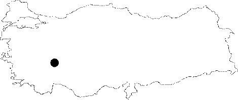 |
For photographs please click on the photo...  |
|
Type:
|
Tumulus |
|
Altitude:
|
m |
|
Region:
|
Aegean |
|
Province:
|
Afyonkarahisar |
|
District:
|
Dinar |
|
Village:
|
Tatarli |
|
Investigation Method:
|
Excavation |
|
Period:
|
|
|
|
|
  |
|
| It is located at the Tatarli Village; 40 km far from the Dinar District of the Afyonkarahisar Province. Cleaning activities were held in 1993 under the direction of M. Üyümez on behalf of the Museum of Afyon. The grave-under-tumulus is in the north-south direction. The walls of the grave chamber were made by cut andesite blocks during the Phrygian Period; inner sides being covered by wood. The wood was decorated with paints of sphenx; warrior; chariots; and winged bull motifs. It was also used during the Roman Period by the additon of a dromos with stone walls. |
| Location: The Tatarli Tumulus is located on the Suhut-Dinar Motorway, 145 km away from Afyonkarahisar, and 35 km away from Dinar. It was founded on a rocky hill to the west of the Tatarli-Suhut road, 3 km northeast of the Tatarli Town. |
| Geography and Environment: |
| History: |
| Research and Excavation: |
| Stratigraphy: |
| Small Finds: |
| Remains: |
| Interpretation and Dating: |

