|
©The Archaeological Settlements of Turkey - TAY Project
|
|
|
|
|
|
Incirlitepe |
|
|
For site maps and drawings please click on the picture... 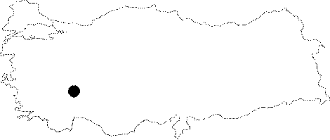 |
For photographs please click on the photo... 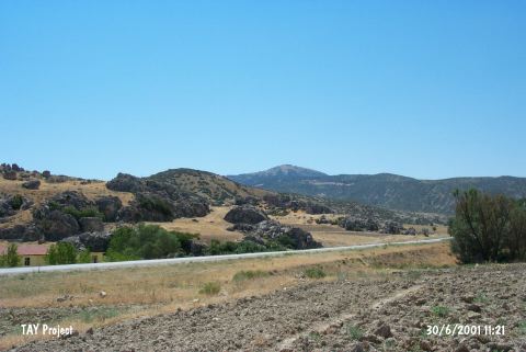 |
|
Type:
|
Flat Settlement |
|
Altitude:
|
880 m |
|
Region:
|
Mediterranean |
|
Province:
|
Isparta |
|
District:
|
Gönen |
|
Village:
|
Gümüsgün |
|
Investigation Method:
|
Survey |
|
Period:
|
Ceramic |
|
|
|
 |
|
| Location: This site lies northwest of the city of Isparta; and southeast of the town of Keçiborlu. It is west of the Isparta-Burdur highway. |
| Geography and Environment: A 30x100 m area on the southern terrace of the Incirlikaya Rock outcrop; which faces the plain at the northern tip of Burdur Lake; yielded ceramics and other finds. The site has been called Incirlitepe after the local name for the place. Özsait has referred to the site as Incirli I; to avoid confusion with the nearby site of Incirli. Although the site faced much natural destruction and erosion in 1983; a thin layer of cultural material deposit still remains. The spring immediately beneath the rock-outcrop on which the site lies; must have served as a water source for the early settlers at this site. |
| History: |
| Research and Excavation: The first surveyor who discovered the site of Incirlitepe is E. Bostanci; who visited the site in 1959 after returning from his excavations in Antalya at the sites of Beldibi; Kumbucagi and Belbasi. Bostanci reports his surveys at Incirlitepe yielded obsidian and flint chipped stone tools which he has assigned to the Late Neolithic Period [Bostanci 1959:131]. In 1983; M. Özsait conducted a systematic and detailed surface survey at the site during his survey of the Lakes Region and the villages of Gölbasi and Koçtepe. |
| Stratigraphy: Neither Bostanci nor Özsait mention any other period at the site other than Late Neolithic-Early Chalcolithic. |
| Small Finds: Pottery: Özsait reports that he collected hand made fine sand and mica tempered; buff; brown; light brown ware with buff slip or painted decorations in red; beige and brown [Özsait 1991b:64-65]. Chipped Stone: The only information provided on the chipped stone tools is that both obsidian and flint was used as a raw material. |
| Remains: |
| Interpretation and Dating: The rock outcrop which faces Çorakova; the extension of the Keçiborlu Plain by Burdur Lake; may have served as a home for early hunter gatherer inhabitants during the transition from the Epipalaeolithic to the Neolithic Periods. This is one reason why the site should be re-researched in further detail. |