|
©The Archaeological Settlements of Turkey - TAY Project
|
|
|
|
|
|
Kanlitas |
|
|
For site maps and drawings please click on the picture...  |
For photographs please click on the photo... 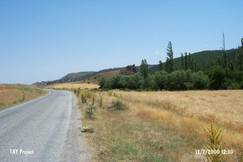 |
|
Type:
|
Mound |
|
Altitude:
|
1000 m |
|
Region:
|
Central Anatolia |
|
Province:
|
Eskisehir |
|
District:
|
Inönü |
|
Village:
|
Asagikuzfindik |
|
Investigation Method:
|
Excavation |
|
Period:
|
Middle Late |
|
|
|
 |
|
| Location: It Iies north of Eskisehir; 1 km east of Asagi Kuzfindik village. |
| Geography and Environment: It is located at the northern side of an elevation; which is in the middle of a valley. Kuzfindik stream flows from the south-southeast of the mound. This area is locally known as Kanlıtas Mevkii. The amount of abrasion cannot be clearly determined since the surrounding area of the mound is subject to heavy farming. And the Kuzfındık Creek which flows right beside the mound have filled the basis of the plain with debris covering the Western and Eastern parts of the settlement partially. With the information on hand it can be suggested that the settlement used to be closer to the river bed. Despite all odds it is determined that the radius of the mound is at least 100 m with the surveys carried out on the surface of the mound [Türkcan 2011.305]. |
| History: |
| Research and Excavation: Discovered by the Archaeological Museum of Eskisehir; the site was revisited by T. Efe in 1989. The excavations led by A. Türkcan from Anadolu University were initiated in 2013 [Türkcan 2015]. |
| Stratigraphy: During the survey carried out in 2009 the distribution of the potteries found among the periods point to EBA and Chalcolithic Age. Very few of the findings belong to MBA and LBA [Türkcan 2011:305]. |
| Small Finds: Architecture: The mound is revisited in 2009 for a more in depth research. The mound rests on a 24 meters high rock. The height of the mound independent of the rock is measured as 18 m [Türkcan 2011:304]. The excavations were initiated in 2013 and the studies carried out in three plan squares (O14, O15 and N15) on the slope and hill on top of the rock in which Kanlitas Höyük rests. During the excavations conducted in Trench N15, a large oven and a large necked jar were found below the surface. Remains of a wall and a stone pavement adjacent to this wall were exposed below the burnt fill and stone debris in the south the trench. Post holes were determined on the pavement (which was paved with flat stones). Large amount of marble bracelet, semi-worked marble fragments, flat stone celts, and various chisels, hammers and ground stone fragments indicate that this area was used as marble bracelet workshop. An oven was exposed at the northeast corner of the trench. The dome-like section of it rests on the east profile of the trench. It is believed that the oven has two phases. During the removal of mudbrick rubble found at the southeast corner of the trench, it is observed that the mudbrick became more solid. Moreover, flat stone arrangement built with sand stone slabs, which probably represents a floor, was exposed. It is believed that these stones belonged to the "road pavement" that descends down or the threshold in front of the area between the wall and oven. Stone clusters, the function of which has not yet been clarified, were unearthed in the center of Trench O15 in the south of Trench N15. Remains indicating a floor were found in the area between those stone clusters. Below this layer, gray soil containing ash in high density was exposed. The stone clusters in the southeast of the trench were removed and a wall built with broken stones was found at the southwest edge. This wall probably joins the wall located at the northeast corner of Trench O14. In Trench O14, located to the southwest of Trench N15, a wall joining the extension of bedrock was exposed. The wall sits on a clay leveling. Its upper section was built with flat sand stones. On top of these stones, mudbrick body rises. An oven was exposed in front of this wall. About a dozen ground and grinding stone (one of them bears traces of ochre) were found in the small area flanked by stones in front of the mouth of the oven. These finds indicate that this area was used for food preparation. In the same trench, a wall extending in the northwest-southeast direction was exposed. The surrounding area of the wall was covered with a compressed clay floor containing pebbles. It is possible to suggest that a leveling floor was aimed to make by placing irregular stones on the floor. A burnt fill was determined on top of the fills belonging to floor and wall. The thickness of this burnt fill ranges from 10 cm to 20 cm. It extends towards Trench N15 as well and covers a large area. The architectural remains exposed in 2013 show that the walls were built on bedrock in accordance with topography of the area. The data recovered so far suggests that the last phase of the hill was ended with a fire. It is believed that Kanlitas was a settlement built on bedrock and surrounded by a city wall like Güvercinkayasi. These two settlements are contemporary with each other [Türkcan 2015]. Pottery: Sherds were also found at the field; west of the elevation. During the surface collection of Efe; sherds; resembling the sherds of Asmainler and Orman Fidanligi; were collected. The decorated ceramics are richer in variety than those found in Orman Fidanligi. In addition; dark faced burnished sherds were found. When all the potteries obtained from 2009 surface scan are analyzed, the result is a repertoire of potteries covering a period from 6th Millennium to 3rd Millennium BC that is reflecting Early, Middle and Late Chalcolithic Ages, and EBA I and EBA II. The used material features gray-brown color (heavily) and black coating (rarely) which is similar to Orman Fidanligi's Middle Chalcolithic material. And very rarely, red and purplish-red painted, non-coated, plain surfaced potteries belonging to Early Chalcolithic Period are obtained. Also some Middle Chalcolithic Period materials are encountered similar to those found in Bursa Ilipinar settlement's VB layer. Among the material obtained are various vessels with necks, bowls with sharp profiles, pots with collapsible mouths, collar-necked pots, shallow and deep pots, bowl-type plates with handles, pots with horizontal or vertical handles, various bowls with convex mouths, and pithoses. The handles are of a typical handle form. And the flat bases are of a typical base form. Pedestal base forms are also encountered though their exact heights are unknown. Some wares uncovered have decorations painted over them, while few others feature dark faces and incised/grooved decorations as well as banded decorations made with "Furscentich" technique. This decoration is positioned above the body and shoulders having vertical, diagonal, or chevrons form. The few decorated pieces found feature close similarity with those potteries found in Orman Fidanligi Chalcolithic Period. Shallow, fluted decorations are seen alongside grooved, printed, embossed, and painted decorations. And samples of black-topped wares on black burnished wares are of particular interest. The painted vessels are divided in two groups: beige coated vessels and purplish-red painted pots. The pots with black painted decorations have two main groups: those feature red on crème or white decorations, and those feature purplish-red decorations applied directly on non-coated, burnished surface [Türkcan 2011:306-307]. Chipped Stone: Stone tools consist of flakes and blades. A few borers were found. There are also backed blades and a few retouched blades. Similar tools were found in Orman Fidanligi as well. Flake tools consist of retouched and non-retouched flakes. Blades on flakes are quite few. Based on the preliminary studies, stone tools were made out of flint in various color and type, opal, chalcedony, quartz and quartzite. Among the stone tools, there are stone borers, sickle blades, side scrapers, retouched blades, end scrapers, notched tools and blades [Türkcan 2015]. Ground Stone: The most remarkable items found are the arm-ring shaped disks made of marble with a thinned or broken center showing that they were in the process of being produced. Among the basalt tools are cylindrical pestles approximately between 15 and 20 cm length with slightly narrower tips (5 pieces), a mortar featuring a tripod, and grinding stones (some intact and some in pieces) [Türkcan 2011:307]. Bone / Antler: A thin fish idol of approximately 8 cm long is found in an illicit excavation hole on top of the mound. It probably is an ornamental item with the hole on the eye was used for hanging on the neck [Türkcan 2011:307]. |
| Remains: |
| Interpretation and Dating: A.U. Türkcan from Eskisehir Anadolu University made a research and studied the ceramics of the settlement in 2008 [Türkcan 2009:1]. The study on ceramics from survey is somehow an inspection on ceramics along with careful study earlier made (Efe 1990). The pottery with many variations surely has many dimensions on understanding the character of Chalcolithic Porsuk culture and its relations (or probably an acculturation). The cultural contact between the Eskisehir and NW Turkey as well as Central Anatolia (ie Konya Plain and Northern Central Anatolia) is still not fully understood yet. The new excavations in Bursa area like Aktopraklik, Barcin Hoyuk with already known Eastern Marmara sites in that period (Asagi Pinar, Toptepe, Yarimburgaz) are promising for the limits or influence of Porsuk culture. The new strata from Kanlitas Hoyuk and new absolute dating (C 14 and thermoluminescance) might well give more results in understanding the evolution and its relations with NW. Anatolia. Presumably, from the end of the Middle Chalcolithic Period Ñat the earliestÑ, the pottery of the two regions exhibits an overall parallel development. Kanlitas pottery seem to display all sequence of Porsuk culture ceramics and probably more of it within complex interactions between NW Anatolia and Balkans since 6. mill. BC [Türkcan 2009:5-6]. The mound grows wider as it extends away from the rock bed it rests on. It can be suggested that the mound is built beside a rock bed that raises independent of the plain land on purpose. Having such a location, Kanlõtas Mound reflects the period when it was preferred to select a site location on valley slopes, high ridges, and valleys. Samples of this approach were unseen before in West Anatolia [Türkcan 2011:304]. |