| ©The Archaeological Settlements of Turkey - TAY Project | ||||||
|
|
||||||
Kanlitas |
||||||
|
|
||||||
| Ages | Maps | Photos | ||||
| Chalcolithic |
 |
 |
||||
|
|
||||||
|
Type:
|
Mound | |||||
|
Altitude:
|
1000 m | |||||
|
Diameter:
|
m- Direction: | |||||
|
|
||||||
|
Region:
|
Central Anatolia | |||||
|
Province:
|
Eskisehir | |||||
|
District:
|
Inönü | |||||
|
Village:
|
Asagikuzfindik | |||||
|
|
||||||
|
Destruction :
|
Illicit Digging - Agriculture | |||||
|
|
||||||
|
TAYEx:
|
Visited - 13/7/2000 | |||||
|
|
||||||
|
Registration State:
|
For detailed registration information please refer to Turkish pages. | |||||
 |
||||||
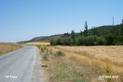
| Location: It Iies north of Eskisehir; 1 km east of Asagi Kuzfindik village. |
| Geography and Environment: It is located at the northern side of an elevation; which is in the middle of a valley. Kuzfindik stream flows from the south-southeast of the mound. This area is locally known as Kanlıtas Mevkii. The amount of abrasion cannot be clearly determined since the surrounding area of the mound is subject to heavy farming. And the Kuzfındık Creek which flows right beside the mound have filled the basis of the plain with debris covering the Western and Eastern parts of the settlement partially. With the information on hand it can be suggested that the settlement used to be closer to the river bed. Despite all odds it is determined that the radius of the mound is at least 100 m with the surveys carried out on the surface of the mound [Türkcan 2011.305]. |
| Destruction Details: The eastern section of the mound is damaged due to agricultural activities. Traces of illicit diggings were also observed [TAYEx 13.7.2000]. |