|
©The Archaeological Settlements of Turkey - TAY Project
|
|
|
|
|
|
Taraççi |
|
|
For site maps and drawings please click on the picture...  |
For photographs please click on the photo... 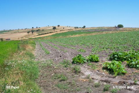 |
|
Type:
|
Mound |
|
Altitude:
|
21 m |
|
Region:
|
Marmara |
|
Province:
|
Balikesir |
|
District:
|
Gönen |
|
Village:
|
Körpeagaç |
|
Investigation Method:
|
Survey |
|
Period:
|
|
|
|
|
 |
|
| The mound lies north of Balikesir; 2.5 km west of Körpeagaç village; on the bank of Gönen Çayi. This area is also known as Halkali Mevkii. It is discovered in 1989 by M. Özdogan and sherds resembling those from Kumtepe Ib are collected from around the mound. Other finds date to Late Neolithic Age and EBA 1. Code H 7 / 6. The mound was researched again during the survey performed by Yalçikli in 2010. Neolithic and Chalcolithic potsherds have been found in high quantity on the upper part and the eastern part of the hill and on the west part, EBA sherds have been exposed. A complete stone tool dating to Chalcolithic/EBA were found in the site and delivered to Bandirma Museum as inventory [Yalçıklı 2012:213]. |
| Location: The mound-site is north of Balikesir and lies close to the village of Ayvalidere and 2.5 km west of the village of Körpeagaç; a municipality of the Gönen district. The site also lies along Gönen Stream. This area is also known as Halkali Mevkii. Code H 7 / 6. |
| Geography and Environment: The mound has been destroyed recently since many sites in this region have been leveled by a grader. It has been reported that the conical part of the mound has disappeared. |
| History: |
| Research and Excavation: |
| Stratigraphy: |
| Small Finds: |
| Remains: |
| Interpretation and Dating: |