|
©The Archaeological Settlements of Turkey - TAY Project
|
|
|
|
|
|
Yassihöyük 2 |
|
|
For site maps and drawings please click on the picture... 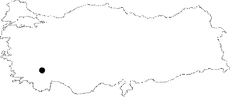 |
For photographs please click on the photo... 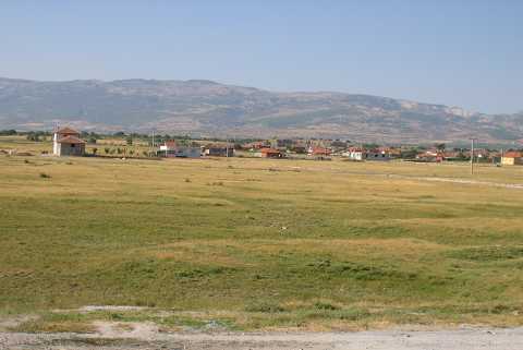 |
|
Type:
|
Mound |
|
Altitude:
|
905 m |
|
Region:
|
Mediterranean |
|
Province:
|
Denizli |
|
District:
|
Acipayam |
|
Village:
|
Yassihöyük |
|
Investigation Method:
|
Excavation |
|
Period:
|
EBA II EBA III |
|
|
|
 |
|
| Location: It lies on the northern side of the Yassihöyük Village (a sub-district at present); 8 km north of the Acipayam District; southeast of Denizli Province. It can be reached via the motorway running from Denizli to Acipayam through an exit to the village on the left/east. |
| Geography and Environment: The western ridges of the mound located on the western part of the Acipayam (Acibadem) Plain house fresh water springs. The mound consists of two hills; the larger eastern hill measures 350x200 m in dimensions. 14 m high above the plain level; it is a round mound [Duru 1999b:pic 1] while the western hill is squat compared the eastern one. It is reported to measure 190x150x5 m [Duru 1999b:132]. Duru claims that the cultural deposit goes down at least 4 m below the plain level and the lower levels have been locked because of the plain earth. The southern and southeastern parts of the larger hill have been damaged in big areas such as 80x50 m and 60x40 m due to the removal of soil by the villagers. |
| History: |
| Research and Excavation: It was discovered by J. Mellaart and identified as an EBA I-II settlement. Continuous damages made it necessary to conduct a small salvage excavation in 1997 by R. Duru. The excavation was conducted to identify the cultural stratification of the mound and illuminate the prehistoric position of the Acipayam region in Western Anatolia. It takes place in the registered archaeological sites list prepared by Ministry of Culture and Tourism. |
| Stratigraphy: Both the surface collection and the finds of sounding revealed that the site had been inhabited from the beginning of the third millennium BC to the midst of the first millennium BC. Fragments of the Roman Period mudbricks are accompanied with fragments from the Archaic and Phyrigian periods and EBA. |
| Small Finds: Architecture: Trench B opened 275 cm deep only on the southern part of the eastern hill yielded 4 building levels all dating to EBA. A wall fragment resembling part of a fortification wall was recovered from the upper level. The fragments of stone foundations 40-45 m thick recovered from the lower level are finds of other building levels. Pottery: The common ware is the one with blackish gray paste and black surface color. Some samples of this ware are decorated with matt white incisions. The most common form is plates with out-rolled lips. Also found are spouted pitchers. Among the surface finds; a decorated spouted pitcher is interesting. Ground Stone: Two disc-like; elbows projected and round headed flat idols in marble are dated to EBA III by R. Duru. |
| Remains: |
| Interpretation and Dating: The building levels uncovered in trench B are all dated to EBA II by R. Duru [Duru 1999b:133]. He compares pottery finds with the pottery of the building levels XVII-XIII of Beycesultan. Furthermore; depending on these finds; he proposes that the region of Acipayam is oriented to Western Anatolia and Cyclades rather than Central Anatolia. It is believed that future excavations will reveal more specific information about EBA II and I. |