|
©The Archaeological Settlements of Turkey - TAY Project
|
|
|
|
|
|
Saraga ITÇ Mezarligi |
|
|
For site maps and drawings please click on the picture... 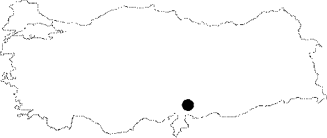 |
For photographs please click on the photo...  |
|
Type:
|
Cemetery |
|
Altitude:
|
m |
|
Region:
|
Southeastern Anatolia |
|
Province:
|
Gaziantep |
|
District:
|
Karkamis |
|
Village:
|
Kelekli |
|
Investigation Method:
|
Excavation |
|
Period:
|
|
|
|
|
 |
|
| Location: Saraga is located on the west bank of the Euphrates; about 800 m northeast of the village of Keleklioglu (Sara); in the Karkamis district of the province of Gaziantep. The village is reached by an asphalt road that runs parallel to the river after leaving the Gaziantep-Urfa highway at Birecik. |
| Geography and Environment: The cemetery is located 800 m to the southwest of the settlement of Saraga; between the mound and the village of Keleklioglu; on the west and north skirts of Sara Mezar Harabe; which was identified during G. Algaze's survey [Algaze et al. 1994:51]. Leveling for modern cultivation during the 1980s resulted in the area north of Sara Mezar Harabe being completely stripped; and it is believed that dozens of graves disappeared. Since the graves cannot be seen on the surface with the naked eye; the exact extent of the cemetery cannot be gauged. The continuous watering and ploughing has caused the soil to become extremely hard and this has caused a certain degree of damage for the graves [Sertok-Kulakoğlu:2002a:375]. |
| History: |
| Research and Excavation: Excavation began in this area when the villagers brought EBA vessels; during the 1999 season fieldwork of Saraga mound. The cemetery was investigated in 2000; during the Saraga excavations coordinated by METU TAÇDAM Salvage Project of the Archaeological Heritage of the Ilisu and Carchemish Dam Reservoirs; by a team under the co-direction of K. Sertok (Gaziantep Museum) and F. Kulakoglu (University of Ankara; Faculty of Languages; History and Geography). |
| Stratigraphy: The excavation only focused on a 5x5 m area to the northwest of Sara Mezar Harabe. At a depth of 20-30 cm below the topsoil were found two graves dug into the earth and constructed from wide limestone blocks. |
| Small Finds: Grave No. 1: This grave; abutting the south side of the trench; was covered with a flat slab; measuring ca. 1x1 m; that slipped from its original position; slightly to the north. The grave measures 1.30x0.80 m. The entrance at the east was closed by a wide flat slab; placed on end. Vessels heaped in front of the entrance; many of which were broken with pieces missing; were mostly fruit-stands. When the cover of the grave was removed; it could be seen that the long north and south sides were constructed from large flat limestone blocks; while the short west side was formed from the bare earth. The grave goods piled at the west and north sides inside the grave were mostly fruit-stands; like those at the entrance. There were no other grave goods apart from pottery and no skeletal remains were found. All that indicated where the body had been placed was the space defined by the grave goods at the north and west sides. Grave No. 2: Compared to the first grave; this one is simpler and poorer in respect of both construction and grave goods. Three sides of the grave were the bare earth of the pit dug into the ground; only the top was furnished with a cover of two limestone blocks and the east side with a wide slab placed on end. The grave goods consisted of four fragmentary fruit-stands lined up along the south side of the grave. No vessels had been left at he entrance and no skeletal remains were found [Sertok-Kulakoglu 2002a:375]. Pottery: The large number of vessels from the two graves excavated in 2000 whose existence was brought to attention through the examples found by the villagers in 1999 throw light on a period that has not been revealed from the mound. Among these vessels; the most important group consists of the champagne glass pots. Within the group; there are three different types. The largest type in the group consists of those measuring 20-25 cm in height; made from a fabric that has not been subjected to any preparation; formed on a slow-turning wheel and fired at a medium temperature. This type has a low wide foot; a cylindrical pedestal and a wide shallow bowl with sharp vertical sides. The rims are generally thickened on the outside. The bowl and pedestal have been made separately and then joined. In comparison; the second type is made from a more carefully prepared fabric and wheel-turned. This example is almost 50 cm high; with a slight cylindrical pedestal; on top of which sits crookedly a shallow bowl; rounded at the bottom; with short vertical sides and a rim thickened in the form of a band. The pedestals of all three groups are decorated with horizontal grooves and three rows of triangular openings made in opposite sides. The third type; ca. 50 cm in height; again has a broad foot and a cylindrical pedestal; but with a deep hemispherical bowl with in-turned rim thickened on the outside. Thousands of examples of these types of champagne glass pots were found in Birecik Dam EBA cemetery. They were also encountered in Haci Nebi graves; some 5 km west of this cemetery; on the west bank of Euphrates; and in the EBA levels of Zeytinlibahçe; some 4 km south of Birecik. All these finds show that the vessels had their origin in this region. The small number of bowls and vases found in Saraga graves are also of types that commonly represent this period in the region [Sertok-Kulakoglu 2002a:377]. |
| Remains: |
| Interpretation and Dating: These two graves in the EBA Saraga cemetery; besides proving that there existed a settlement during the early part of the Early Bronze Age; for which no evidence had been found during the 1999 excavations on the Saraga mound; and the rising water of the dam reservoir prevents the possibility of discovering any evidence for this in the future; supports the theory that the communities living in the region at this time had a special local culture; characterized particularly by fruit-stands; as well as other regional features. The first graves of this type and age were noted at the beginning of the 20th century during the Carchemish excavations; and more recently at Haci Nebi Tepe; just on the east bank of Euphrates; and Birecik Dam cemetery. In a few of the examples in Birecik Dam cemetery; it was observed that there were not stones placed on some sides of the graves. The fact that there was a limited use of stone in both of Saraga graves might be explained by the non-availability of suitable stone. On the other hand; it is known that in some of Carchemish and Birecik dam graves no skeletal remains were found. This situation; which also was observed in the two Saraga graves; may be related to natural causes rather than to some ritual or religious explanation [Sertok-Kulakoglu 2002a:376]. |