| ©The Archaeological Settlements of Turkey - TAY Project | ||||||
|
|
||||||
Saraga ITÇ Mezarligi |
||||||
|
|
||||||
| Ages | Maps | Photos | ||||
| EBA |
 |
 |
||||
|
|
||||||
|
Type:
|
Cemetery | |||||
|
Altitude:
|
m | |||||
|
Diameter:
|
m- Direction: | |||||
|
|
||||||
|
Region:
|
Southeastern Anatolia | |||||
|
Province:
|
Gaziantep | |||||
|
District:
|
Karkamis | |||||
|
Village:
|
Kelekli | |||||
|
|
||||||
|
|
||||||
|
|
||||||
|
TAYEx:
|
Not visited - | |||||
|
|
||||||
|
Registration State:
|
For detailed registration information please refer to Turkish pages. | |||||
 |
||||||
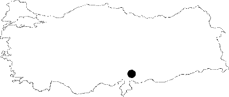
| Location: Saraga is located on the west bank of the Euphrates; about 800 m northeast of the village of Keleklioglu (Sara); in the Karkamis district of the province of Gaziantep. The village is reached by an asphalt road that runs parallel to the river after leaving the Gaziantep-Urfa highway at Birecik. |
| Geography and Environment: The cemetery is located 800 m to the southwest of the settlement of Saraga; between the mound and the village of Keleklioglu; on the west and north skirts of Sara Mezar Harabe; which was identified during G. Algaze's survey [Algaze et al. 1994:51]. Leveling for modern cultivation during the 1980s resulted in the area north of Sara Mezar Harabe being completely stripped; and it is believed that dozens of graves disappeared. Since the graves cannot be seen on the surface with the naked eye; the exact extent of the cemetery cannot be gauged. The continuous watering and ploughing has caused the soil to become extremely hard and this has caused a certain degree of damage for the graves [Sertok-Kulakoğlu:2002a:375]. |
| Destruction Details: |