|
©The Archaeological Settlements of Turkey - TAY Project
|
|
|
|
|
|
Iasos |
|
|
For site maps and drawings please click on the picture... 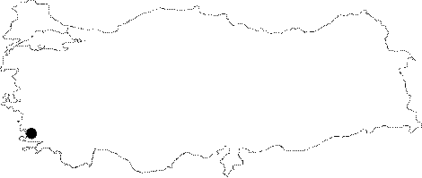 |
For photographs please click on the photo...  |
|
Type:
|
Flat Settlement and Cemetery |
|
Altitude:
|
5 m |
|
Region:
|
Aegean |
|
Province:
|
Mugla |
|
District:
|
Milas |
|
Village:
|
Kiyikislacik |
|
Investigation Method:
|
Excavation |
|
Period:
|
Roman Hellenistic Classical Archaic Mycenean |
|
|
|
 |
|
| Location: It lies where the ancient city of Iassos is located; next to the Kiyi Kislacik Village; 31 km west of the Milas District; west-northwest of the Mugla Province. It is situated at the end of a small bay in Güllük Gulf; ashore of Aegean Sea. |
| Geography and Environment: The settlement stands on a cape next to the Küllük Port while the cemetery is out of the ancient city. |
| History: The excavations revealed that it had been inhabited since the Middle Bronze Age. The layers dating to this period yielded many Minoan potsherds overlaid by a layer of the Mycenaean potsherds and buildings [Bean 2000:58]. The city had been inhabited from the prehistoric ages to the Proto-Byzantian Period [Levi 1970:14]. According to the legend; the ancient city of Iassos was founded by the colonists from Argos. It is believed that the person depicted on the Iassos coinage as the founder was the leader of the colony [Bean 2000:58]. It is also known that other than Argos colonists; the son of Neleus; founder of Miletus was also involved in the colonization process and such immigrations took place during the 9th century BC [Bean 2000:59]. Based on the information provided by ancient sources; the city was founded on an island close to the mainland [Strabo 14; 2; 21]. The sea trade was a significant source of income for the city [Baldoni et al. 2004:11]. It became a member of the Delian League in the 5th century BC; and the tribute initially set as 1 talent was raised to 3 talents in 425 BC. The Spartans who attacked Iassos in 412 BC upon request of the Satrap Tissaphernes looted the city [Bean 2000:59]. It is known that Iassos sided Athenians during the wars between Athens and Sparta. Short before the Spartans' victory over Athens in 404 BC; the Spartan general; Lysander captured a city named Thasos in Caria; destroying all men; and selling all women and children into slavery. Many archaelogists interpreted that Thasos was in fact Iassos as no Carian city exists under this name [Bean 2000:59-60]. The dominance of Sparta in the region was ended in 394 BC. when the Athenian fleet defeated them near Cnidus. Shortly after this victory; it seems that Iassos was part of an alliance with the other significant Aegean cities consisting of Rhodes; Samos; Cnidus; Ephesus; and Byzantion; which ended with the King's Peace in 387 BC; ceding all the Anatolian cities to the Persian dominance [Bean 2000:60]. In 334 BC when Alexander the Great laid siege to Miletus with his army; the Iassians contributed one ship to the Persian fleet. According to inscriptions; after Alexander's death apparently the city came under the influence of three privateers [Bean 2000:61]; who later became citizens of the city. After Alexander the Great; she was under the dominion of the Ptolemies for a while. In c. 220 BC; Olympichus had an independent dynast in the region. The Iassians presented their complaints to Rhodes about the attacks of Podilus; an officer of Olympichus; on the people of Iassos. In the meantime; Philip V of Macedonia gave support to protect Iassos. But; at the end of the 2nd century; Philip V marched into Caria; including Iassos; and later on he was compelled to leave by Romans in 196 BC [Bean 2000:62]. After a while; upon invasion of Antiochus III; the Romans made a plan to attack Iassos under the command of Aemilius in 190 BC. The Iassians took separate sides; one side favoring Romans while the other side; Antiochus III. Consequently; the city defeated the Roman attack after the intervention of Rhodes [Bean 2000:62]. One inscription refers to a letter by Laodike; sister of Antiochus; to Antiochus. The letter provides information about the poor administration of Philip V and an earthquake as well as a struthion (financial office) established by Laodike for the prosperity of Iassos. The income from the sales in struthion were distributed to the dependent population. In return; the Iassians issued a decree on behalf of Antiochus III and Laodike; prasing and thanking them; and they presented sacrifices to Antiochus as he saved the city from Philip V [Bean 2000:63]. Laodike was associated with the cult of Aphrodite as she helped to the young girls to marry. Such apprecitations for Laodike and Antiochus III can also be seen in the inscriptions uncovered in Teos [Bean 2000:63]. In 190 BC; Antiochus III suffered defeat against the Romans; and Iassos became under the dominion of Rhodes. The independency she gained in 168 BC lasted until she was incorporated into the Province of Asia in 128 BC In 88 BC; Iassos was punished during the war between Mithridates and Romans for siding with Mithridates. She served as one of the customs of the province during the reign of the Roman Empire. The coinage seems to continue until the 3rd century AD [Bean 2000:63]. Afterwards; she became a religious center under Aphrodisias [Bean 2000:64]. |
| Research and Excavation: Investigated by Chandler in 1770s; it was visited by Texier in 1835; and Ross in 1844 [Madran 1989:228; 230; 232]. In 1960-72 D. Levi excavated the site and the cemetery. From 1972 to 1984 C. Laviosa carried out excavations at Iasos. F. Berti took over the excavations and led the team until 2010 on behalf of the Italian School of Archaeology at Athens. Iasos is listed as an officially registered archaeological site by the Ministry of Culture and Tourism. In 2011, M. Spanu launched excavations again in Iasos and excavated until 2013. Milas Museum directed excavations between the years 2014 and 2017. Today, A. Baldiran is in charge of the excavations at Iasos. |
| Stratigraphy: |
| Small Finds: |
| Remains: The peninsula on which the city rises measures around 900x450 m; with a height of 80 m from the sea level. The isthmus with a castrum over it was formed by an alluvion forced by the river running from a plain on the mainland. The hill in the middle of the peninsula is the acropolis. The circuit walls enclosing the castrum are from the 12th-13th centuries AD. The western slope of the peninsula is very steep; where the traces of an intense inhabitation is observable on the narrow plateau. The southern and eastern slopes have less inclination; and mainly used for Residences. Harbor: It has two harbors; the larger one to the east is restricted by a promontory [Baldoni et al. 2004:52]. The western harbor has been obliterated by two pillars which at present remains under the water. These pilears are presumably dating from the Early Imperial Period; similar to the buildings related with the harbor and agora. The investigators believe that the tower guarding the eastern harbor was built during the Middle Byzantian Period [Baldoni et al. 2004:60-61]. City Wall: Strechting 2 km long with an average thickness of 1.83 m; the city wall makes sharp turns. It was erected with trapezoidal isodomic blocks. The parapet on the city wall has windows. It was pierced by a total of nine towers with a square plan; five to the west; and four to the east. The city is accessible through three separate gates. The southern one is protected by a tower. The second one lies to the east while the third to the northwest [Baldoni et al. 2004:58; Bean 2000:65; Akarca 1998:114; 140]. Due to the masonry and an inscription probably belonging to the eastern gate; the city wall should have been dated to the 4th century; most probably to the reign of Hecatomnus in 377-353 BC It was renovated during the Roman and Byzantian Periods several times; and some gates were cancelled [Baldoni et al. 2004:58-59]. There is a gate on the northeastern corner of the island; which underwent restorations several times. The arch is from the Byzantine Period. The bastion near the gate is dated to the Classical Period due to an inscription from the 5th century defining the boundaries of the Zeus Sanctuary. Agora: It lies to the northwest of the city; south of the castrum on the isthmus. Started to function as an agora in the 4th century; it measures c. 107x87 m. It is accessed by a monumental gate from the east. To the north and east lie walls made of well cut stones; with a naiskos (See Temple) in the middle in Ionic order dating to the 2nd century BC; and also altars with square/rectangular foundations [Baldoni et al. 2004:65-66]. During the 2nd century BC construction of stoas around the agora was initiated; but they were damaged during an earthquake after a short while; and the constructions had not been completed due to a series of successive earthquakes [Baldoni et al. 2004:66-67]. The columns of stoa have plain bodies in a Corinthian order. The walls and the floor are covered with marble plates. The southern stoa has two naves; topped by a pitched roof. On the western section there is a shop and a library. The large space with an entrance of three arcs on the eastern section is believed to be the caesarium based on the inscriptions. The southern wall of the agora is pierced by a monumental gate. It is reported that there used to be a propylon with a tetrastyle plan before that. Its closure might have been related with the restoration of fortifications following the attacks by the Heruli [Laviosa 1972:45]. The stoa allows access to the Sanctuary of Artemis Astias [Baldoni et al. 2004:80-81]. A basalt head of Osiris; the Egyptian god; with a long feathered head-dress was found near the gate leading to the south. It is known that Carian mercenaries served in the Egyptian army during the 6th century as well as the 7th century to which this find is dated. Based on this find; it was believed that Iassos had close relationships with the pharaons of Egypt during that period. On the rear wall of the same stoa; fragment of a marble entablature; probably belonging to the naos of a temple; was found. The relief on this entablature depicts a rider in a chariot and below a young rabbit. It is from the 6th century BC. The southern stoa is the stoa of Poseidon referred in the traditional Carian inscriptions from the 4th century BC. It is reported that the decrees and enactments related with the citizens were announced here [Baldoni 2004:84-85]. 3000 silver coins from the Caracalla-Gallienus period were uncovered in an urn under the floor of a shop to the west of the southern gallery. Absence of any post-Gallienus coinage indicates that Iassos was destroyed by Heruli. Also found are many honorary inscriptions from the Hellenistic Period; one of them is related with a person from Hydisos [Levi 1970:16]. The west stoa has a single nave; and its wall is similar to the city wall of the 4th century BC. A sounding on the western section of the agora revealed layers from the Hellenistic Period to the Archaic Period. Also; it was found that this area was used as a cemetery during the Geometric Period [look. Bean 2000:70-71; Levi 1968:36-37]. In the east stoa; similarly with a single nave; there is an agoranomion (office of the market police) and a heroon from the Late Hellenistic Period (See Heroon) [Baldoni et al. 2004:82]. A monumental gate with three arches rises near the southern corner of the eastern edge. It gives access to the agora from a street running from the east [Laviosa 1972:44]. According to an inscription dated to 136-138 AD on the architrave; two Iassians; Dionysius and Hierocles; dedicated the stoas to Artemis Astias; the goddess of the city; and divine Hadrian; Antonius Pius and "very sweet homeland of Iassos". The north stoa has a double nave; and covered by a pitched roof like the south stoa. There is a semi-circular pool to collect the water and also a niche on the southern wall [Baldoni et al. 2004:81; 83]. The agora is dated back to the Hadrian Period based on the architectural characteristics and the inscription on the architrave. In 2006 season; excavations were resumed in two areas within the agora: in the three-roomed building; facing on the eastern stoa and along the western stoa. The building along the Eastern Stoa shows a rectangular plan divided into three adjoining and communicating rooms; originally covered by vaults. Before the building lies a small vestibule axially aligned with the stoa and accessible by a few steps. Two trenches were transversally dug in the central room; through its full width from wall to wall; to preserve the century-old tree grown inside. A thick earth deposit of about 2 m showed a stratigraphic sequence that confirmed a long periodof occupation and revealed seven levels of use since the building was erected. To the earlier phase dates a room with four arched doorways providing communication with flanking rooms and six niches set into the walls; shallow and of different heights; the floor (probably made of marble slabs) lies about 0.70 m above the stoa's ground level; and has a large (4.60 m width) and shallow (0.16 m depth) marble basin incorporated into it; the basin was provided with the drainage channel that; running under the vestibule's surface; got into the agora's drains. The recent results of the excavation have improved our understanding of the layout of this building; even though much remains unknown about this structure that must have played an important role in the agora and that - like wise others - was built over structures of the Hellenistic age [Berti 2008:296]. Along the Western Stoa; the excavation was extended for about 30 m noth-south and app. 10 m east-west; the ground showed a steep slope to the west due to the urban walls still raising to a considerable height [Berti 2008:296]. Excavation along the Western Stoa was extended for about 30 m north-south and approximately 10 m east-west; the ground showed a steep slope to the west due to the urban walls still raising to a considerable height. Remarkable results came from the urban walls sector rather than from the western stoa. here indeed was individuated the so called dipylon; that is; the original western entrance to the town. The inner side of this section of the walls was constructed with dry-blocks of small or middle size extracted from a local quarry and - before curving to an obtuse angle to form an ambulacrum giving access to the gate- it was buttressed by two abutting walls of same size but different height; built with similar dry-blocks. Such a buttress occupied most of the space between the fortification and the back wall of the stoa; interrupting a series of successive rooms taht faced on the colonnade and -in the imperial age agora- backed the eastern and western colonnades of the square. The last retrievals suggest that behind the city's gate; guarded by two square towers; a large; truncated cone shaped space was enclosed within the walls. The recently unearthed section is irregularly rectangular; as it is bounded by the stoa's back wall to the east; the fortification to the south and a wall to the north; the latter must have been built later; as it lies parallel to the southern side of the original plan; while both sides of the walls must have converged toward the gate and its towers. Two passageways flanked the gate from west to east; both lined with reused schist slabs; two abses for small honorific statues; a cylindrical base and a marble one almost square in shape; stand against the southern side of the gate. A lot of evidence recovered here suggests that this area of the city remained in use for a long period. Ceramic materials and coins found suggest that the are was occupied from Hellenistic age to the tenth century AD and over; as attested also by restoration works made in the agora in the early Roman imperial age. Excavations in this area gravitating toward the walls revealed a complex stratigraphy of building phases as sugegsted also by the sound dug against the walls; in the room near the current entrance to the agora. Dug down to the base of the walls; the sound could uncover only the upper row of foundation blocks. A pre-existing building; almost parallel to the walls; whose remains curved to the east prevented us from continuing the excavation [Berti 2008.296-297]. In 2007, the excavation focused on room B at the western stoa of the Agora, where in 2005 an olive tree had been left in situ, as well as on the area strecthing to the point where the stoa and the rooms behind it are intersected by the Isthmus fortress which during the Byzantine period encroached upon the north western area of the square. Leaving aside the structural features of the rooms (B1 and B2) into which room B is subdivided that is the possibility to establish a chronology for the fire that cause their abandonment: on the B2 floor level a small hoard of fifteen coins dated to the reign of Gallienus (253-268). Both fire traces and coins evidence strongly suggest that the disorders that went with and followed the Gothic invasion area of ca. 265 AD affected also Iasos, a circumstance not mentioned by historical sources but that possibly led to the hiding of the 2997 silver antoniniani hoard which was even found in the agora, not far from the current excavation area. As far as B2 is concerned, it apparently had the function of storage room for material destined to be sold or reused, as attested by hundreds of marble wall and pavement slabs still tidily stecked against its walls. It yielded also fragments of small marble sculptures, a bronze hand belonging to a large size statue as well as further artifacts, a corn quern complete with both parts (catillus and meta) and some interesting sherds from a mould-made vase. The team expanded a further trench toward the north, where the stoa intersected the city walls dated to the fourth century BC. According to the most accredited hypothesis the walls opened toward the land with two entrances that, provided with towers, protected the access to the town. In between, thus, there was a large trapezodial courtyard, open to the sky, taht received a pavement in the course of time. In the centre of this area a small apsidal building dated to the imperial period is currently visible [Berti 2009:11-13]. In 2010, in the Agora, from the low north-south walls come some of the rare architectural elements of the stoa, for example, a Corinthian capital [Berti 2013:223]. They now move towards the middle centuries of the empire and the opposite side of the agora: the find of an inscribed block promises something new. In addition to the patron goddess of the city (Artemis Astias), the inscription of the eastern stoa, as is known, bears dedications to Hadrian and Antonius Pius and the names of some of the dedicators. Although the incompleteness of the emperors, nevertheless it cannot date later the 138 AD. However, on one of the three lines incised on the recently discovered architrave block is mentioned an empress defined "mother of camps". This has to be Julia Domna, who received the title in 195 AD after accompanying Septimius Severus on his eastern campaigns [Berti 2013:224]. The study of the water supply system of the western sector of the agora made it possible to survey the numerous clay pipes of the imperial phase which, coming form the aqueduct, distributed the water by branching out or running along the stylobate, and the decidedly earlier (late archaic-classical) the spring within the open area of the agora. It was enclosed in a small rectangular basin oriented north-south, and on the south side opened in a channel with a marked gradient (about 20 cm in one 5-m stech!). The basin is of masonry and has the bottom covered with limestone slabs and well fitted. The canalization too, 1.08 m deep and 0.55 m wide, is faced with slabs on bottom and sides, with smaller slabs on top, these with frequent gaps to allow inspection. We know nothing of how the basin was covered, but, since it had to be protected from all kinds of pollution, it could only have been made to isolate the underlying space from the outside. The groundwater coming up through the joins of the bottom filled the basin and ran through the canalization, as occurs even today, depositing lime. The lime which left sediment in the canalization until it filled it (as observed in the stretch that was opened and cleaned) appeared associated with potsherds only on the bottom and beneath the cover [Berti 2012:225]. The 2011 campaign concentrated on the area measuring 20x15 m located outside the walls surrounding the Castle of the Isthmus. Remains belonging to the Roman architectural complex of this sector underwent deep transformations during the time. Since the northwest corner of the agora was included the Castle of the Isthmus, it has been entirely vanished. In the excavated sector closest to the Castle, the collapsed stones and blocks of the upper section of its surrounding wall were encountered. It is possible to say that these blocks collapsed due to an earthquake occurred in the 15th century AD. Remains belonging to the Roman Period are very scanty. The pre-existing structures have been damaged, since the continuity of life in the area and the wide reuse of materials. Only the stylobate of the stoa, the lower bases of the inner portico and some parts of the marble pavement remain. Among the findings recovered from this area, the fragments of Greek inscriptions are noteworthy. Most of them were intentionally broken and re-employed in Late Antique structures [Spanu 2013:446, 447]. In 2012, the studies conducted in the North Stoa. Late Roman / Early Byzantine phases of the North Stoa consist of one or two roomed, small sized dwellings. Only the extentions of the walls of these dwellings were preserved. The walls were weakly built. Some of the blocks were taken from the Agora belonging to Roman Period. These blocks were connected to each other with a low quality of mortar. The studies yielded important data about the Roman Period of the Agora. However, this section of the North Stoa has been severely damaged in comparison to the East Stoa. The portico has completely vanished in the antiquity. Only stylobate blocks of which were preserved in situ. All the architectural remains located at the same elevation with the portico have been entirely damaged. During the excavations conducted in the East Stoa, a structure in quadrangular plan belonging to Late Roman Period was exposed. This structure was built with stones without using mortar. The entrance is located to the south section. During the late phases of the Agora, this structure was probably re-designed as an oven. In this period, different sections of the portico were used for craft and industrial activities. The oven is located on the marble slabs belonging to the pavement of Roman Stoa. This pavement is quite well preserved in this area. Some tabulae lusoriae (tabula board game) were incised on the surface of this pavement [Spanu 2015]. Tripartite Building: In 2012, the studies were carried out in the large tripartite building facing to the East Stoa of Agora. The function of this building has not yet been clarified. The excavations concentrated on the central room, especially the back section of the building. It is believed that this building was in use from Roman Period to the 12th-13th century AD. After removing the Byzantine fills in the room, the floor belonging to Roman Period was reached. It was paved with white and black mosaic stones. Only a small part of it is preserved up to date. The studies show that the room was divided into two sections during Late Roman Period. These sections were separated by two marble posts [Spanu 2015]. Basilica: It lies to the east of the city; next to the eastern gate. Abundant number of Mycenaean ceramics was found [Levi 1971:39]. Bouleuterion: It lies to the south of the agora. It measures 21.8x25.7 m with a rectangular plan [Baldoni et al. 2004:78]. It is flanked by arched entrances [Bean 2000:70; Levi 1968:36]. It looks like a small theater with its seating rows and rounded central area. The seating section is divided into three by the downstairs; and into two by a diazoma-like walkway. The end of seats are marked with lion's pawns. On the background of the central area; there are three doors and two rows of columns. The building is enclosed by a vaulted corridor. The relief of a bearded male figure leaning his left hand against a cushion presumably depicts Iassos; the founder of the city. With its very qualified workmanship; it is dated to the first half of the 4th century BC It is reported that the bouleuterion was originally built in the 4th century BC; and the extant structure is from the 1st century AD [Baldoni et al. 2004:78-79]. A sounding carried out in the outer section of the eastern wall of bouleuterion yielded earlier walls; and postherds from the Geometric; Orientalizing; Archaic and Classical Periods in the underlying destructed layers associated with the Spartan occupation [Baldoni et al. 2004:93; Levi 1970:16]. Caesareum: It is located on the southern edge of the agora; and eastern edge of the bouleuterion. Measuring 13x17 m; it has a rectangular plan. Theater: It lies on the eastern slope of the hill [Baldoni et al. 2004:104]. It faces the northeast. The cavea carved into the bedrock consists of 21 seating rows. The analemma wall of the cavea is made of embossed stones [Bean 2000:69]. The rows of seats can be accessed through two staircases from the outside of the theater. The cavea was divided into two by a diazoma. The inner stairs leading up to diazoma didn't survive to the present day. The stage building reflects characteristics of the Roman Period. It is pierced by three doors opening into the back rooms. An inscription on the northwestern side of the monument; presumably started to be constructed during the 4th century BC; indicates that a person; called Sopatros; dedicated the analemmata; the adjacent staircase and the podium to Dionysos and citizens. The inscription is from the 2nd century BC; and related with the renovation of the monument. The gathered material reflects restoration of the stage building during the Roman Period when the stage building was moved forward [Baldoni et al. 2004:105]. On the wall; there are inscriptions from the 2nd century BC about the payments made to fluters and comedians by some of the citizens [Bean 2000:70]. Gymnasium: It is located to the north of the agora; adjacent to the Middle Age castle on the isthmus of the island. A big structure of gymnasium including a bath was detected under a deposit from the Roman Period. Paved with small stones; it is at the same level with the northern wall of the agora [Levi 1970:14-15]. Aqueduct: In the mainland; there extends an aqueduct to the northwestern part of the city. The 2011 campaign concentrated on the terminus of the Roman aqueduct that provided water the urban baths and the big cistern located at the edges of the city [Spanu 2013:447]. Temple/Sanctuary: The Temple of Demeter and Kore: It is located on a terrace; on the southern end of the peninsula. The two rectangular rooms in different dimensions are from the second half of the 6th century BC. One of them has a rectangular hearth. Three female masks with diadem were uncovered in this room. They are Rhodesian type of terracotta masks. Other than these; two goddess figurines of the same material; figurines of female water carriers; miniature water jugs; models of votives such as bread; cake; flowers and fruits were unearthed. Abundancy of these terracotta finds dating to the 5th century BC and afterwards suggests that the area was related with Demeter and Kore. The portico around the rooms was added during the 5th century BC while the propylon to the north during the 4th century [Baldoni et al. 2004:116-117]. The Temple of Artemis: It is located in the center of agora. It is located adjacent to the northern nave of the basilica built during the Byzantine Period. It is a very small structure in the Ionic order. It faces south; and it has been presumed that it was built to protect the cult statue; probably belonging to Artemis. Architecturally it is dated back to the 2nd-1st centuries BC [Baldoni 2004:76-77]. The Sanctuary of Artemis Astias: The square area in the north-south direction was arranged during the Hellenistic Period. It is surrounded by Doric porticos. The southern gallery is connected to three rooms through big arched doors. An inscription refers to the structure as exedra. It is from the Period of Commodus. There is a votive inscription for Aphrodite Strateia in the western room. It was dedicated to the Emperor and Artemis by an Iassian upon death of his son. The votive materials uncovered here include qualified potsherds. Probably the state archives known to be protected by Artemis were kept in these rooms [Baldoni et al. 2004:90-92]. The excavations in the southern gallery yielded finds from the Bronze Age to the Byzantine Period. Among the important finds is a letter from Laodike; wife of Antiochus III. The letter refers to the benefactions by the Queen during the catastrophic events following the earthquake in Rhodes in 228 BC. The western gallery included a statue of a sculptor from the School of Aphrodisias inside a rectangular niche [Baldoni 2004:93]. The Temple of Artemis within the sanctuary has an in antis plan; and dated to the 4th century BC [Baldoni 2004:90]. The Sanctuary of Zeus Megistos: It is located inside the walls of the Eastern Gate; approximately 64 m away from it [Bean 2000:71]. It is a small in antis temple. It might have been used as a naiskos or thesaurus. In front of the temple; there is a stone-paved area including bases for votives and inscriptions; and behind it there is a platform; which was found to be used from the 6th century BC to the Hellenistic Period based on the votive material. In the stone-paved area; a kouros torso from 520 BC was found. The inscribed text in Carian in the rim of a crater indicates the presence of Carian population in the city [Baldoni 2004:97-99]. The stone paved area to the southeast of the temple is surrounded by Doric columns. Among the rooms; the northern one has a rectangular plan and apsis. The across room has an arched entrance. Mosaic was found in the floor of the western rooms. The southern rooms have a view of the main street. A basilica was built at the same place during the Byzantian Period [Baldoni 2004:100-101]. Sanctuary of Labrys: It lies to the east of the agora. It consists of two rooms extending in the north-south direction. It has thick walls. The investigators believe that these two rooms are not interrelated. The upward faces of the limestone foundation blocks in the corners of the southern room were processed. There is a circular altar in the southeastern corner of the room. It is believed that this structure was dedicated to Zeus Labrandeus because of abundant number of lead plates in the shape of labrys and a relief of labrys on a marble pyramid. The structure is dated to the Classical Period [Baldoni 2004:74-75]. Furthermore; it is reported that there is a small temple from the Hellenistic Period in the northwestern section of the acropolis [Baldoni 2004:120]. In 2007, a continuous portico had existed and the excavation team exposed its beaten earth floor: apparently a unusual feature considering the importance of this sector of the town where even a Ionic dystile temple in antis, dated form the fourth century BC, stood at the centre of it. Judging by the assemblage abbreviations, Doric columns and capitals seems to have been reused in the stoai. A column, partly mallet-smashed with the use of wedges to obtain building materials of lime attests the systematic quarrying of buildings during the late period. Significant is also the retrieval of fragments of statues (a head, a foot) and a banded lintel apparently belonging to a window [Berti 2009:13-14]. Heroon: In the mainland; the structure located next to the aqueduct was described as a heroon from the Roman Period [Levi 1968:37]. The outer wall was damaged by a big chapel-like structure [Laviosa 1972:44]. The other heroon in the eastern stoa of the agora is located on two ancient tombs. The columns among the extant architectural remains indicate that they supported a entablature in Doric order. The relief stone blocks in the immediate vicinity belong to an altar. The depictions include bulls adorned with garlands. Based on its style; it was dated to the 1st century AD [Baldoni 2004:82-84]. Residences: The residences were mainly on the eastern and southern slopes of the acropolis. They were built according to the nature of the land or on terraces. Mosaics and frescs are common in the houses dating to the Roman Period [Baldoni 2004:108]. Within a complex on the southern residential section of the hill; there were a series of chambers; a cistern with three small pools and a toilet. The same complex yielded colorful and figured panels of geometric designs as well as mosaics with depictions of animals such as dolphins and seahorses [Baldoni 2004:113]. One of the houses in this slope is known as "The House of Mosaics". It was built on a natural terrace. The backyard measuring 13x12 m with columns is paved with marble. Geometrical mosaics are observed on three sides. In fron of the backyard with columns; there is a porticoed atrium. The upper floor is accessible through a western staircase. The rooms were decorated with mosaics of geometric designs. Built during the 2nd century AD; it has traditional characteristics of the Hellenistic architecture [Baldoni 2004:111-112]. The residential area on the terraces to the southeast of the theater was partly excavated. Two insulae separated into two by a stone-paved road were found. The road leads to the theater; then to the shore. The houses from the 4th century BC were built on the structures from the 6th century BC. The rooms are small. This area had been also inhabited during the Roman Period. To the west of the road lies a room with a very colorful mosaic pavement dating to the 2st century AD [Baldoni 2004:109-111]. Numerous constructions, single or in groups of two to four, abutted one another inside the construction; in this case as well, this is indicated by the holes on the walls where the roof beams were inserted. The excavation has clarified some of the structural characteristics of teh construction to the left of the principal entrance (called Building 1) and of one of the rooms of the building that corresponded to the tower Q (Called Room A of Building 11) [Berti 2011:177]. Necropolis/Graves: The necropolis dating to the Early Bronze Age on a plain ground to the north of the city yielded 96 sarcophagi. The same necropolis is overlaid by another necropolis from the Hellenistic Period. Dating to the 3rd-2nd centuries BC; it consists of sarcophagi around two grave altars. The grave gifts were left on the grave altars. A necklace consisting of 28 gold leaves were found on one of them [Baldoni 2004:124-127]. The Funerary Monument ("Fish Market"): It lies to the immediate east of the aqueduct; to the northwest of the city. The structure presumed to be the Fish Market referred by Strabo; by the Italian archaeologists at the beginning of the 20th century; was in fact a tomb from the 2nd century AD The area of 40x48 m is surrounded by porticos. It is accessible from the eastern gallery. There rises a funerary monument in the form of a temple on a high platform in the middle of the area. Four columns rise on the western facade. The buried columns on the side walls are in Corinthian order. Some vessels to maintain the bones were left in niches and stone benches on the walls of the burial chamber; which measures 10x7 m. The Syrian influence on the structure is obvious. It is still unclear to whom this funerary monument was dedicated; but presumably to a very important person. The blocks extracted from the stone quarries were stored here during the Byzantian Period [Baldoni 2004:127-129]. Next to the isthmus lies the Necropolis of Burial Chambers. Sixty burial chambers were found scattered around the northern slopes of the modern village along two rows in the east-southeast direction under the rocky ridge overlooking the small port. Majority of them consists of a single chamber with stone walls and a vaulted ceiling. The entrance is frontal or lateral. Some have an entrance with a flight of steps. There are grave inscriptions placed at the lentil of the door or among the wall stones. A marble altar with a garland uncovered in one of these graves is from the Late Hellenistic Period. A pigeon-like ampulla uncovered in another grave was produced in the workshops of Ticino in the Northern Italy during the 1st century AD [Baldoni 2004:132-135]. The Necropolis of the Geometric Period: Situated on the western part of the agora; it is dated to the 8th-7th centuries BC Nearly 100 graves were uncovered in the east-west direction overlaying the the Bronze Age structures. Sarcophagi; pithoi and terracotta sarcophagi were unearthed. There are more than one burial in each grave. The grave gifts include bronze ornaments like bracelet; necklace; ring; hairpin; and fibula and a small iron blade. Among the interesting items are terracotta needles found in the graves of females and terracotta feeding bottles and sea urchin shells found in the children's graves. The forms of potsherds include jug; goblet; small crater; bowl and amphora. They are decorated with motifs like bands; ribbings; triangles; zigzag lines and spearheads [Baldoni 2004:72-73]. The excavations revealed that the sarcophagi were from the Mycanean Period layers [Levi 1971:38-39]. Presence of sarcophagi and pithoi graves indicates the application of both traditions at the same time [Levi 1971:38]. Workshop: Some extramural structures were found in a narrow valley; which might have been workshops or Residences [Rocca 1992b:72]. Quarry: It is located on the Arigedige Hill near a structure; presumably a Lelegian building. It is believed that it is related with the terrace located nearby; and the blocks extracted from the quarry were collected here. Most probably the terrace was in use from the 2nd century BC to the end of the Roman Imperial Period. Based on the traces; it is suggested that some sections of the quarry was used earlier; between the Archaic Period and 1st century AD. However; no exact dating is available as it was used within a very long time framework [Benoit 2003:335-348]. Structure with an Unknown Function: A rectangular big structure dating to the Middle Bronze Age and Late Minoan Period was uncovered to the east of the necropolis; underlying three structures with a rounded plan and two terracotta sarcophagi with an eliptical form [Laviosa 1972:44]. Miscellaneous: To the north of the gulf in which Iassos has a shore; a number of Lelegian structures were recorded. One of them on the road has an oval plan. The walls were erected by big raw stones; where the holes between were filled by small stones. The second structure which is located in the valley adjoining the road has a similar plan and architectural features. There are extant remains of an enclosing wall. It is believed that their position is not strategical. They might have been a "station" or a simple shelter for shepherds [Benoit 2003:341]. On the southern slopes of the quarry; there are remains of a Residence from a small village and a tomb. The Residences usually have two-story; two rooms and they reach up to 3 m high at some places. Based on their constructional techniques; they are dated to the Byzantian Period; and they were probably related with the stone quarries and their administration [Benoit 2003:337-338]. |
| Interpretation and Dating: The fortress was probably not used beyond the fourteenth to fifteenth centuries, as suggested by the materials found. Interesting among there are the plaques from a corselet. This type of armor is quite well attested in Italy in late medieval/Renaissance castles and fortresses, while it is rare elsewhere. |