| ©The Archaeological Settlements of Turkey - TAY Project | ||||||
|
|
||||||
Iasos |
||||||
|
|
||||||
| Ages | Maps | Photos | ||||
| EBA IA Greek-Roman |
 |
 |
||||
|
|
||||||
|
Type:
|
Flat Settlement and Cemetery | |||||
|
Altitude:
|
5 m | |||||
|
Diameter:
|
m- Direction: | |||||
|
|
||||||
|
Region:
|
Aegean | |||||
|
Province:
|
Mugla | |||||
|
District:
|
Milas | |||||
|
Village:
|
Kiyikislacik | |||||
|
|
||||||
|
|
||||||
|
|
||||||
|
TAYEx:
|
Visited - 24/9/2000 | |||||
|
|
||||||
|
Registration State:
|
Registered For detailed registration information please refer to Turkish pages. | |||||
 |
||||||
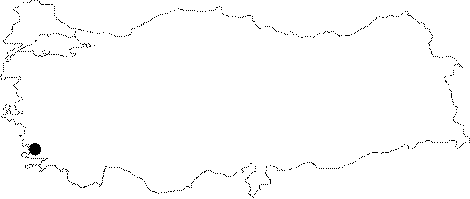
| Location: It lies where the ancient city of Iassos is located; next to the Kiyi Kislacik Village; 31 km west of the Milas District; west-northwest of the Mugla Province. It is situated at the end of a small bay in Güllük Gulf; ashore of Aegean Sea. |
| Geography and Environment: The settlement stands on a cape next to the Küllük Port while the cemetery is out of the ancient city. |
| Destruction Details: |