|
©The Archaeological Settlements of Turkey - TAY Project
|
|
|
|
|
|
Hanay Tepe |
|
|
For site maps and drawings please click on the picture...  |
For photographs please click on the photo... 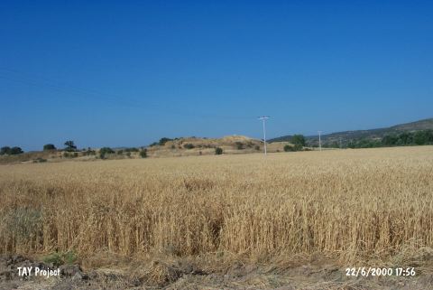 |
|
Type:
|
Mound |
|
Altitude:
|
92 m |
|
Region:
|
Marmara |
|
Province:
|
Çanakkale |
|
District:
|
Merkez |
|
Village:
|
|
|
Investigation Method:
|
Excavation |
|
Period:
|
Classical |
|
|
|
 |
|
| It lies north of Kemerdere, a tributary of the Kara Menderes Stream on the east side of the Çanakkale-Ezine motorway, approximately 20 km north of Ezine, southeast of the provincial center of Çanakkale. Three main layers were identified and classified as B, C and A from top to bottom at Hanay Tepe. The layer B is dated to the Early Bronze Age, and it is studied in two builidng levels, B1 and B2. The layer C is dated to the Troy levels VI-VII, and the layer A is dated to the Classical Period. Several graves from the Byzantine Period are observed on the top. It takes place in the registered archaeological sites list prepared by Ministry of Culture and Tourism. |
| Location: It lies north of the Kemerdere stream; a branch of the Kara Menderes on the eastern side of the Çanakkale- Ezine motorway; about 20 km north of Ezine; southeast of the Çanakkale Province. |
| Geography and Environment: It is located at the end of a ridge where the valley of Kermerdere opens into the Menderes Plain. The prehistoric finds are located on the southern slope of the settlement which was suggested to be the ancient city of Thymbra. Kemer stream flows to the south-southeast of the site. The road to Alexandreia Troas and Geyikli passes between the stream and the mound. On the northeastern section of the ridge that the settlement lies on are the facilities of TIGEM. The damage; even partly; still continues. |
| History: |
| Research and Excavation: |
| Stratigraphy: |
| Small Finds: |
| Remains: |
| Interpretation and Dating: |